Michael Fish's NBC26 Storm Shield weather forecast
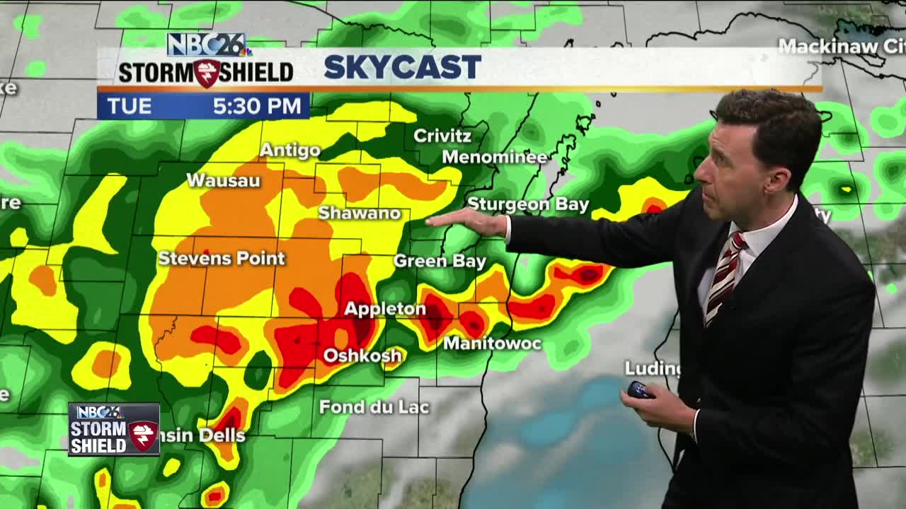
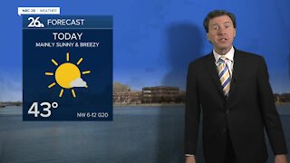
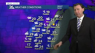
As some clean up from last night's storms, just be aware that we're not out of the woods for more strong storms developing this afternoon. This will be along a cold front that will be pushing in from the NW. The main threats will be gusty wind, hail, and more heavy rain for those with already saturated soil. Highs will top out in the low- to mid-80s. That cold front passes through the area tonight with more areas of showers and T'storms, mainly before midnight. Once again, with the very unstable atmosphere, some of these could bring severe weather with some of the main threats going from gusty wind and hail, to that heavy rainfall, especially the farther south you live. Once this front passes, our overnight temperatures will become more tolerable with readings in the upper-50s. Cooler & less humid weather returns by Wednesday with an isolated shower or sprinkle possible and highs only in the upper-60s. Wednesday night will be cool and quiet with lows in the upper-40s. Thursday looks very comfortable with sunshine highs in the low-70s. There will be a chance of a shower or T'storm of Friday night into Saturday, but as of now, your Labor Day weekend really doesn't look too bad with highs in the upper-70s to around 80 through Monday.
-
 1:45
1:45
WGBA
1 year agoStudents excited to start at "huge and beautiful" Vel Phillips Middle School
278 -
 2:33
2:33
WGBA
3 years agoMichael Fish's NBC 26 weather forecast
4 -
 2:19
2:19
WGBA
3 years agoMichael Fish's NBC 26 weather forecast
3 -
 2:26
2:26
WGBA
3 years agoMichael Fish's NBC 26 weather forecast
4 -
 2:27
2:27
WGBA
3 years agoMichael Fish's NBC 26 weather forecast
4 -
 2:24
2:24
WGBA
3 years agoMichael Fish's NBC 26 weather forecast
3 -
 1:57
1:57
WGBA
3 years agoMichael Fish's NBC 26 weather forecast
2 -
 2:31
2:31
WGBA
3 years agoMichael Fish's NBC 26 weather forecast
7 -
 1:50
1:50
WGBA
3 years agoMichael Fish's NBC 26 weather forecast
4 -
 2:27
2:27
WGBA
3 years agoMichael Fish's NBC 26 weather forecast
1