Michael Fish's NBC26 Storm Shield weather forecast
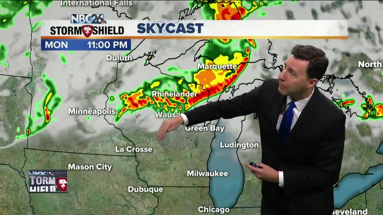
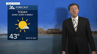
The likelihood of a strong, bowed segment of T'storms working its way across parts of the state is becoming more likely tonight. When you see a bowed signature like that, it usually depicts strong winds. The better chance at seeing this will be the farther you live to the northwest. Localized heavy downpours will also be a threat through the night as well. As we head through this morning, there will be some hit-and-miss T'storms, but there will be kind of a lull for many in the rain going into the afternoon. It's going to be a breezy, warm and muggy day with highs will topping out in the mid-80s. Again, tonight looks to get active in many places again with areas of showers and T'storms rolling into the area at times as the night goes on. Once again, any of these storms that develop could be strong to severe with gusty wind, hail and heavy downpours being the main threats. Most of Tuesday during the daytime should probably have another one of those lulls in the precipitation as we wait for a strong cold front to arrive. Highs will top out in the low- to mid-80s. That cold front passes through the area tonight with more areas of showers and T'storms, mainly before midnight. Once again, with the very unstable atmosphere, some of these could bring some gusty wind, hail or locally heavy rainfall. Overnight lows will cool off into the upper-50s. Cooler & less humid weather returns by Wednesday with a morning shower or sprinkle possible and highs only in the upper-60s. There will be a chance of a shower or T'storm of Friday night into Saturday, but as of now, your Labor Day weekend really doesn't look too bad with highs in the upper-70s to around 80.
-
 1:57
1:57
WGBA
1 year agoHow the City of Green Bay is hoping a $1.6M investment will make the community safer for pedestrians
3051 -
 2:33
2:33
WGBA
3 years agoMichael Fish's NBC 26 weather forecast
4 -
 2:19
2:19
WGBA
3 years agoMichael Fish's NBC 26 weather forecast
3 -
 2:26
2:26
WGBA
3 years agoMichael Fish's NBC 26 weather forecast
4 -
 2:27
2:27
WGBA
3 years agoMichael Fish's NBC 26 weather forecast
4 -
 2:24
2:24
WGBA
3 years agoMichael Fish's NBC 26 weather forecast
3 -
 1:57
1:57
WGBA
3 years agoMichael Fish's NBC 26 weather forecast
2 -
 2:31
2:31
WGBA
3 years agoMichael Fish's NBC 26 weather forecast
7 -
 1:50
1:50
WGBA
3 years agoMichael Fish's NBC 26 weather forecast
4 -
 2:27
2:27
WGBA
3 years agoMichael Fish's NBC 26 weather forecast
1