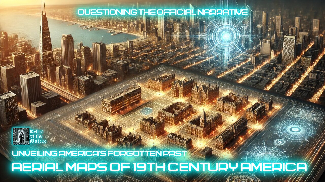
19th Century Aerial Maps of the USA: Evidence of Advanced Cities
🗺️ Decoding the Aerial Maps of 19th Century America 🗺️
Explore the astonishing details in 19th-century aerial maps of American cities, showcasing advanced urban planning that challenges conventional historical narratives. Discover how these maps reveal a sophisticated infrastructure that defies the technological capabilities of the time.
What You’ll Learn in This Video:
🗺️ Detailed analysis of 19th-century panoramic city maps
🏛️ Evidence of advanced urban planning and design
🌌 Theories of a forgotten civilization shaping early America
🔍 Connections between historical maps and global resets
📺 Join us as we analyze the maps that could rewrite America’s history.
👉 Like, comment, and subscribe for more mysteries in the Digital Divinity series.
#oldworld #americanhistory #hiddenhistory #tartaria #digitaldivinity
-
 1:15:41
Steve-O's Wild Ride! Podcast
20 hours agoBert McCracken: The Unlikely Godfather of Hardcore Music
5.43K -
 LIVE
LIVE
Midnight In The Mountains™
1 hour agoGaming w/ Midnight | Arc Raiders w/ SilverFox & Sgt Wilky | 11AM EST
45 watching -
 LIVE
LIVE
dieseldesigns
2 hours agoServer SLAM Appetizer Before RELEASE! // Arc Raiders
47 watching -
 19:20
19:20
Stephen Gardner
1 day ago🚨Trump's latest Marco Rubio ORDER LEAKED by New York Times!
86.9K124 -
 21:33
21:33
Liberty Hangout
2 days agoDemocrats Invite Me Over For Breakfast
11.7K47 -
 2:38:56
FreshandFit
15 hours agoShe Left Her Man To Find A HVM In Miami w/ 6IX9INE
365K156 -
 11:16
11:16
Blackstone Griddles
14 hours agoDouble Roasted Green Chile Smash Burger on the Blackstone Griddle
7.13K2 -
 14:36
14:36
Tactical Advisor
18 hours agoNew Military Thermal Target
12.7K2 -
 2:10
2:10
OfficialJadenWilliams
17 hours agoHow we treated AI in 2023 vs 2025
6.98K4 -
 9:02
9:02
The Shannon Joy Show
18 hours agoWhy is Canada PERSECUTING Dr. Makis
18.3K6