Premium Only Content

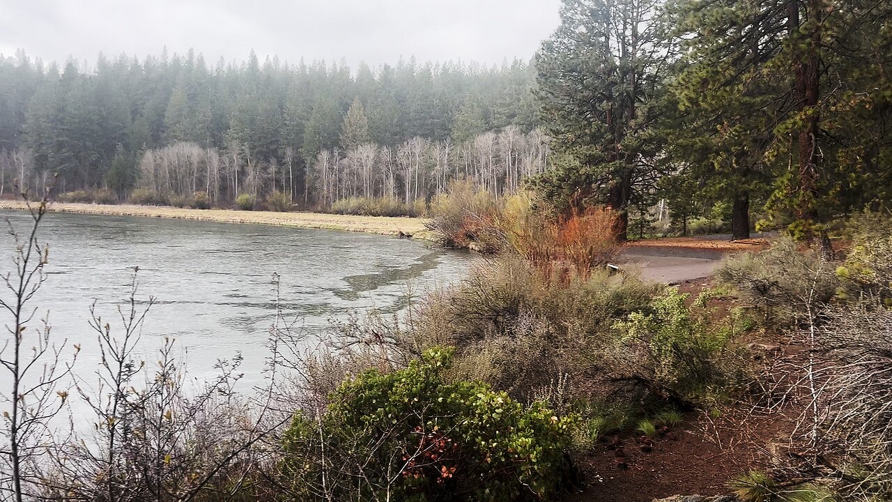
HIKING EXPLORING Aspen Day Use Area & Boat Ramp Launch! | Upper Deschutes River Central Oregon | 4K
In my opinion, there are about 8 Miles of PREMIUM River Shoreline Hiking on Deschutes River Trail along National Wild & Scenic Upper Deschutes River, Deschutes National Forest, Central Oregon.
This is EASILY a TOP 5 River Shoreline Hike in the Great State of Oregon! There are 3 Strategic Approaches to Capture/Tackle this EPIC area:
1) 8 Mile Point-to-Point Hike from Meadow Day Use Area to Sun-Lava Path Trailhead (called East Benham Falls Trailhead on Google Maps), in either Direction, need to arrange transportation at end of Hike!
2) 16 Mile Out & Back Hike from Meadow Day Use Area to Dillon Falls to Benham Falls to Sun-Lava Path Trailhead (called East Benham Falls Trailhead on Google Maps), in either Direction, no transportation logistics required, the Superstar Hiker Method!
3) Break Deschutes River Trail up into 2 separate more leisurely 8-Miles'ish Out & Back Hikes using Dillon Falls as the Midpoint:
a) Meadow Day Use Area Trailhead to Dillon Falls & Back.
b) Sun-Lava Path Trailhead (called East Benham Falls Trailhead on Google Maps) to Dillon Falls & Back.
On April 22, 2022, I Hiked 8 Miles Point-to-Point from Sun-Lava Path Trailhead (called East Benham Falls Trailhead on Google Maps) heading North to Benham Falls, Slough Day Use Area, Dillon Falls, Aspen Day Use Area, Big Eddy, Upper Falls, Lava Island Day Use Area, Lava Island to Meadow Day Use Area. It was a Low of 29F. Here is the FULL HIKE Video Link of that Hike:
On May 6, 2022, I Hiked 8 Miles Point-to-Point from Meadow Day Use Area Trailhead heading South to Lava Island, Lava Island Day Use Area, Upper Falls, Big Eddy, Aspen Day Use Area, Dillon Falls, Slough Day Use Area & Benham Falls to Sun-Lava Path Trailhead (called East Benham Falls Trailhead on Google Maps). It was a Low of 33F. There was a freak Hail Storm that added to the experience:
-
 6:02
6:02
HikingViking
8 days agoHIKING EXPLORING BOTH Boat Ramp Launches @ Trillium Lake | Campground & Day Use Area | Mount Hood 4K
61 -
 17:09
17:09
Guns & Gadgets 2nd Amendment News
23 hours agoWhy I Left The USCCA
23.7K25 -
 21:33
21:33
Degenerate Jay
2 days ago $1.30 earnedThe Best Video Game Movie Ever Made? Sonic The Hedgehog 3 Movie Review
25.2K -
 19:57
19:57
BlackDiamondGunsandGear
3 days agoIS 22LR ENOUGH?
15.7K8 -
 1:59:47
Anthony Rogers
18 hours agoLIVE Comedy @ Cusumano's Pizza (Upstairs)
14.4K1 -
 5:02:46
MoFio23!
16 hours agoNintendo Switch It UP Saturdays with The Fellas: LIVE - Episode #1
99K14 -
 4:26:49
BLoobsGaming
15 hours agoCan I get an Enhance Crystal Weapon Seed please!? MORE Corrupted Gauntlet
147K42 -
 7:35:05
BSparksGaming
1 day agoDynamic Duo! Marvel Rivals w/ Chili XDD
93.8K -
 7:00:42
NellieBean
18 hours ago🔴 LIVE - trying some COD maybe Pals later
92.4K1 -
 1:47:46
SpartakusLIVE
15 hours agoThe Master RIZZLER has entered the building, the 95% REJOICE
43.7K3