Premium Only Content

Current Position of the Magnetic North Updates on Earthquakes for Nov 2nd to Nov 10th
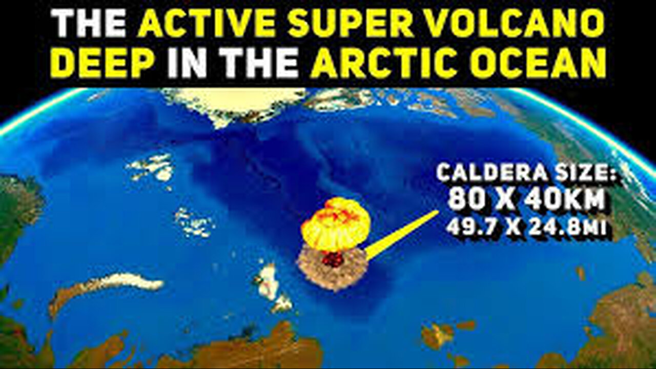
Gakkel Ridge is a mid-ocean spreading center in the north arctic ocean, and home to one of the largest known supervolcanoe on our planet. Interestingly, Earth's magnetic north pole began moving from its location over Canada towards Siberia over the past 100 years, accelerating rapidly in the 1990's, and the trajectory of its movement has it passing directly through the Gakkel supervolcano zone over this year. Earth's magnetic pole in the northern hemisphere is where energy flows into our planet, especially during space weather events like solar coronal mass ejection impacts and geomagnetic storms, and observational evidence in addition to cutting edge geophysics suggests that a link exists between solar activity and earthquake and volcanic activity here on Earth. In this context in the North magnetic pole being situated directly over Gakkel supervolcano is a very large unknown, and worth exploring in greater detail, which we will do in this video.
What is a magnetic field?
A magnetic field is a picture that we use as a tool to describe how the magnetic force is distributed in the space around and within something magnetic. Explain
Most of us have some familiarity with everyday magnetic objects and recognize that there can be forces between them. We understand that magnets have two poles and that depending on the orientation of two magnets there can be attraction (opposite poles) or repulsion (similar poles). We recognize that there is some region extending around a magnet where this happens. The magnetic field describes this region.
There are two different ways that a magnetic field is typically illustrated: Explain : some details
The magnetic field is described mathematically as a vector field. This vector field can be plotted directly as a set of many vectors drawn on a grid. Each vector points in the direction that a compass would point and has length dependent on the strength of the magnetic force. Explain compasses Arranging many small compasses in a grid pattern and placing the grid in a magnetic field illustrates this technique. The only difference here is that a compass doesn't indicate the strength of a field.
An alternative way to represent the information contained within a vector fie
Magnetic field lines never cross.
Magnetic field lines naturally bunch together in regions where the magnetic field is the strongest. This means that the density of field lines indicates the strength of the field.
Magnetic field lines don't start or stop anywhere, they always make closed loops and will continue inside a magnetic material (though sometimes they are not drawn this way).
We require a way to indicate the direction of the field. This is usually done by drawing arrowheads along the lines. Sometimes arrowheads are not drawn and the direction must be indicated in some other way. For historical reasons the convention is to label one region 'north' and another 'south' and draw field lines only from these 'poles'. The field is assumed to follow the lines from north to south. 'N' and 'S' labels are usually placed on the ends of a magnetic field source, although strictly this is arbitrary and there is nothing special about these locations. Explain magnetic field of the Earth
Field lines can be visualized quite easily in the real world. This is commonly done with iron filings dropped on a surface near something magnetic. Each filing behaves like a tiny magnet with a north and south pole. The filings naturally separate from each other because similar poles repel each other. The result is a pattern that resembles field lines. While the general pattern will always be the same, the exact position and density of lines of filings depends on how the filings happened to fall, their size and magnetic properties.
LINK FOR RUMBLE, EARTH CHANGES NEWS CHANNEL
https:// EARTH CHANGES NEWS CHANNEL/c/c-6877865
Earth Changes News Channel
ON PATREON
patreon.com/user?u=15057390
Earth Changes Channel
https://www.youtube.com/@wantitok/videos
Huatulco Food Bank
https://www.paypal.com/paypalme/EarthChangesChannel
Mexico's poverty rate declines from 50% to 43.5% in four years as remittances almost double. MEXICO CITY The poverty rate in Mexico has declined from 49.9% of the population in 2018 to 43.5% in 2022, according to a study published Thursday by the country's poverty analysis agency.
James Wright
PO Box 795 PIE TOWN NM 87827
EMAIL deeptruthdeepimpact@yahoo.com
Telegram it's a great place to meet and put up your links, that you consider is very important and basically to touch base with the family over there so many are doing great work on Telegram with the links
FINE TELEGRAM
Earth Changes News Channel 🌎 Chat Room
THE NEW LINK https://t.me/+9phDoj65mORjMjlh
-
 1:06:12
EARTH CHANGES NEWS CHANNEL
23 days agoCurrent Position of the Magnetic North Updates on Earthquakes for Jan 4th
2554 -
 1:38:57
Glenn Greenwald
4 hours agoWith Tulsi's Hearing this Week, Establishment Attacks her with Lies About Snowden & 702; U.S. Journalist Arrested in Switzerland for Criticizing Israel; China's Leap Forward in AI | SYSTEM UPDATE #397
24.3K45 -
 1:10:08
Donald Trump Jr.
5 hours agoWhat Real Leadership Looks Like, Live with Sen Bernie Moreno | TRIGGERED Ep.210
93.2K135 -
 LIVE
LIVE
The Jimmy Dore Show
3 hours agoCIA Backs Wuhan Lab Leak Theory! Trump Calls for Ethnic Cleansing in Gaza!
18,100 watching -
 57:43
57:43
The StoneZONE with Roger Stone
1 hour agoWhat Will The JFK Assassination Files Reveal? | The StoneZONE w/ Roger Stone
3.4K3 -
 18:24
18:24
Tundra Tactical
4 hours ago $0.96 earnedWhats New With HRT Tactical Gear at SHOT Show 2025
13.7K1 -
 23:27
23:27
Rethinking the Dollar
3 hours agoWealth Protection SECRETS Learned from Wildfires w/ Paul Stone
6203 -
 1:04:30
Battleground with Sean Parnell
7 hours agoPresident Trump Is Flooding The Zone
81.3K6 -
 LIVE
LIVE
megimu32
2 hours agoON THE SUBJECT: 90s Toys, Fat Phobia, and Crying Libs!
165 watching -
 LIVE
LIVE
Right Side Broadcasting Network
10 hours agoLIVE REPLAY: President Trump Addresses House GOP in Doral, FL - 1/27/25
5,610 watching