NBC26 Storm Shield Weather Forecast
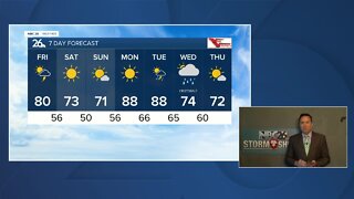
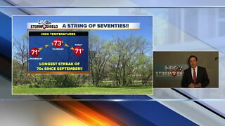
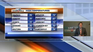
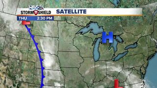
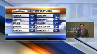
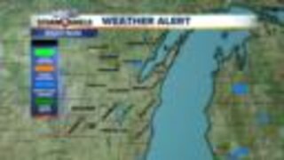
Today, especially this evening, will probably will be the best chance of scattered thunderstorms over the next several days. With daytime heating, we'll probably start to see scattered T'storms develop especially as the afternoon wears on to the NW. If you do end up under one, you could see strong winds and/or hail. It'll be warm and more humid with highs in the upper-80s with cooler readings possible right along Lake Michigan. This evening looks to be our best shot at the more widespread, scattered storms moving in from the NW. Again, some of these could bring some gusty wind or some hail if you do end up under a T'storm. This will gradually end as the evening wears on, then we'll clear out the skies again. Lows will be in the mid-60s. With instability hanging around for Saturday and possibly a little bit on Sunday, there will be chances of afternoon showers or a thunderstorm, but you will have many more dry hours than rain. As of this moment, Monday looks warm, humid and quiet for the most part, with a slight chance of a T'storm to the NW. Highs will be in the 80s/90s with some humidity for the whole weekend. That sounds awfully nice....if you like summer. The Fox River is experiencing minor flooding in Green Lake County. The river is expected to drop below flood stage by Thursday.
-
 1:45
1:45
WGBA
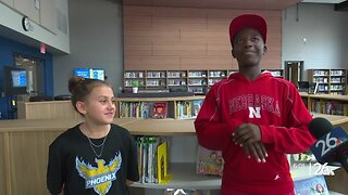
7 months agoStudents excited to start at "huge and beautiful" Vel Phillips Middle School
56 -
 3:24
3:24
WGBA
3 years agoNBC26 Storm Shield Forecast
6 -
 3:24
3:24
WGBA
3 years agoNBC26 Storm Shield Forecast
8 -
 1:29
1:29
WGBA
3 years agoNBC26 Storm Shield Forecast
7 -
 4:01
4:01
WGBA
3 years agoNBC26 Storm Shield Forecast
15 -
 3:38
3:38
WGBA
3 years agoNBC26 Storm Shield Forecast
12 -
 3:17
3:17
WGBA
3 years agoNBC26 Storm Shield Forecast
11 -
 1:32
1:32
WGBA
3 years agoNBC26 Storm Shield Forecast
4 -
 3:35
3:35
WGBA
3 years agoNBC26 Storm Shield Forecast
7 -
 3:51
3:51
WGBA
3 years agoNBC26 Storm Shield Forecast
7