NBC26 Storm Shield Weather Forecast
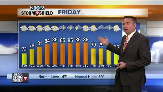
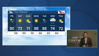
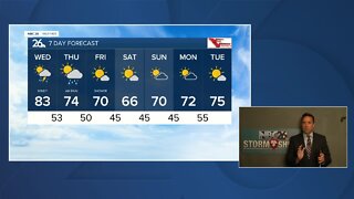
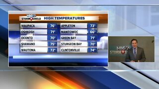
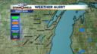
Thursday was the warmest day of the year so far & even warmer(hot) weather is on the way!! Tonight we'll be warm and mainly quiet with lows in the mid 60s. An isolated thunderstorm is possible across the far NW. Friday, this will probably will be the best chance of scattered thunderstorms over the next several days. With daytime heating, we'll probably start to see scattered T'storms develop especially as the afternoon wears on. If you do end up under one, you could see strong winds and/or hail. The SPC has the entire area on a marginal threat of severe weather. It'll be warm and more humid with highs in the mid/upper 80s. With instability hanging around for Saturday and possibly Sunday, there will be chances of afternoon showers or a thunderstorm, but you will have many more dry hours than rain. As of this moment, Monday looks warm, humid and quiet. Highs will be in the 80s/90s with some humidity for the whole weekend. That sounds awfully nice....if you like summer! The Fox River is experiencing minor flooding in Green Lake County. The river is expected to drop below flood stage by Thursday.
-
 3:36
3:36
WGBA
1 year agoWill it be necessary to have both the AC & the heat on during the same day??
3931 -
 3:24
3:24
WGBA
5 years agoNBC26 Storm Shield Forecast
6 -
 3:24
3:24
WGBA
5 years agoNBC26 Storm Shield Forecast
8 -
 1:29
1:29
WGBA
5 years agoNBC26 Storm Shield Forecast
7 -
 4:01
4:01
WGBA
5 years agoNBC26 Storm Shield Forecast
15 -
 3:38
3:38
WGBA
5 years agoNBC26 Storm Shield Forecast
12 -
 3:17
3:17
WGBA
5 years agoNBC26 Storm Shield Forecast
11 -
 1:32
1:32
WGBA
5 years agoNBC26 Storm Shield Forecast
4 -
 3:35
3:35
WGBA
5 years agoNBC26 Storm Shield Forecast
7 -
 3:51
3:51
WGBA
5 years agoNBC26 Storm Shield Forecast
7