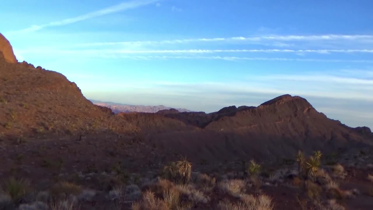
Faults of the Nelson Dump and Artillery Testing Range
Bear Dogs and problems you've never seen.
35.753993,-114.821457
Rocks seen today with updated ages:
15.0 Ma Tdrl Rhyolite
15.1 Ma Tdml Mafic lavas
15.2 Ma Tb Tuff of Bridge Spring
Tdrl Rhyolite and rhyodacite—Modified from Anderson (1977). Massive cliff-forming, mostly quartz-free rhyolite and rhyodacite with phenocrysts of plagioclase, sanidine, and biotite in varying amounts and proportions. Includes some outcrops of Tdr of Anderson (1977). Ages range from 15.04 to 14.93 Ma (40Ar/39Ar; Gans and Bohrson, 1998). Maximum thickness approximately 150 m
Tdml Mafic lavas—Modified from Anderson (1977). Dark-gray and dark-grayish, red-purple andesite flows below rhyolite and rhyodacite unit (Tdrl) and above Tuff of Bridge Spring (Tb). Includes as many as 16 andesite flows with a total thickness of as much as 275 m. Distinctly porphyritic varieties contain about 25 percent phenocrysts of plagioclase, augite, and altered olivine with minor altered orthopyroxene as individual grains and as cores surrounded by augite. Principal accessory minerals are iron oxides and apatite. Pyroxene to olivine ratio is typically about 3:1. Includes some outcrops of Tdm of Anderson (1977). Ages range from 15.1 to 15.00 Ma (40Ar/39Ar; Gans and Bohrson, 1998)
Tb Tuff of Bridge Spring (middle Miocene)—Modified from Anderson (1977). Welded to non-welded, gray to pale-red, quartz-free rhyolitic ash-flow tuff; purplish-gray andesitic lithic inclusions are common. Phenocrysts of sanidine, plagioclase, biotite, augite, and hornblende are present in varying amounts and proportions. Sphene is principal accessory mineral present in variable amounts. Where exposed in vicinity of highway 60, consists of two cooling units that total up to about 180 m thick. Also occurs in isolated outcrops south of Malpais Flattop Mesa and east of Indian Rapids (north of Willow Beach). Originally mapped and described by Anderson (1971), tuff is inferred to have erupted from a caldera in northern Eldorado Mountains (Gans and others, 1994). 40Ar/39Ar ages from outcrops near type section along highway 60 in Eldorado Mountains range from 15.03±0.06 to 15.34±0.06 Ma (Gans and Bohrson, 1998)
Free Preliminary Geologic Map of Black Canyon and Surrounding Region, Nevada and Arizona:
https://pubs.usgs.gov/of/2013/1267/a/
Lost Highway on YouTube:
https://www.youtube.com/watch?v=GNnS2qlqtys
-
 3:01
3:01
Rocks of Eldorado NV
1 month agoOn the Other Hand
241 -
 23:10
23:10
DeVory Darkins
1 day agoBondi issues chilling warning to comey after shocking twist emerges
24.5K75 -
 8:01
8:01
MattMorseTV
11 hours ago $30.76 earnedVance has finally HAD ENOUGH.
62.9K98 -
 15:18
15:18
MetatronHistory
2 days agoThe REAL Origins of the SUMERIANS
13.4K2 -
 22:43
22:43
Nikko Ortiz
14 hours agoGhost Of Tabor Is Like Fent...
18.5K2 -
 17:44
17:44
The Pascal Show
14 hours ago $1.24 earnedNOW LAPD IS LYING?! TMZ Doubles Down On Source's "Celeste Rivas Was FROZEN" Claims
13.5K3 -
 18:05
18:05
GritsGG
15 hours agoThis Duo Lobby Got a Little Spicy! We Have Over 20,000 Wins Combined!
13.9K -
 LIVE
LIVE
Lofi Girl
3 years agolofi hip hop radio 📚 - beats to relax/study to
262 watching -
 37:08
37:08
MetatronGaming
2 days agoWarhammer Shadow of The Horned Rat DOS Version is FANTASTIC! 1995
22K2 -
 2:03:36
FreshandFit
14 hours agoAkaash Replies to FreshandFit w/ Girls
199K27