Premium Only Content
This video is only available to Rumble Premium subscribers. Subscribe to
enjoy exclusive content and ad-free viewing.

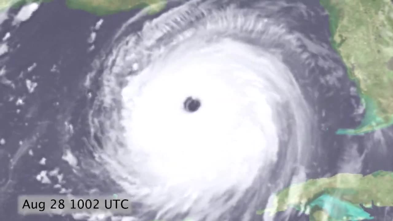
Hurricane Katrina Satellite Timelapse Aug 24-30 2005
1 year ago
331
Hurricane Katrina Satellite Timelapse August 24-30, 2005
Hurricane Katrina appeared suddenly in the Bahamas, moved quickly across southern Florida, intensified to category 5 in the warm-water, mild-wind conditions in the Gulf of Mexico, and then came ashore just east of New Orleans, eventually rupturing the levees and flooding the city. The day/night animation is composed of GOES-12 visible/infrared images of the clouds on top of a color Landsat map.
Loading comments...
-
 2:33
2:33
Earth Wind and Fire
3 days agoStanding on Mount St. Helens Days Before Eruption - May 1980
96 -
 LIVE
LIVE
Dear America
1 hour agoTrump DESTROYS Dems: ‘Blood On Their Hands!’ — America Won’t Survive Without Law & Order”
18,159 watching -
 LIVE
LIVE
Matt Kohrs
5 hours agoStock Market Open: Bulls Push For New Highs || Live Trading Futures
592 watching -
 LIVE
LIVE
Wendy Bell Radio
4 hours agoSay Their Names
6,600 watching -
 LIVE
LIVE
LFA TV
2 hours agoLFA TV ALL DAY STREAM - TUESDAY 9/9/25
8,046 watching -
 1:13:16
JULIE GREEN MINISTRIES
2 hours agoTHINGS THAT WERE BURIED IN YOUR CAPITAL HAVE BEEN FOUND
68K134 -
 LIVE
LIVE
JuicyJohns
1 hour ago $0.29 earned🟢#1 REBIRTH PLAYER 10.2+ KD🟢
105 watching -
 19:37
19:37
BlaireWhite
1 day agoWe Need To Talk About The Trans Shooter, "Robin" Westman.
4.72K8 -
 12:22
12:22
Chad Prather
14 hours agoFinding God’s Timing in a World of Pressure
12.6K2 -
 LIVE
LIVE
The Pete Santilli Show
2 hours agoMORNING STREAM Tuesday September 9, 2025 💣 THE PETE SANTILLI SHOW & SANTILLI REPORT (Monday 9/8)
481 watching