Premium Only Content
This video is only available to Rumble Premium subscribers. Subscribe to
enjoy exclusive content and ad-free viewing.

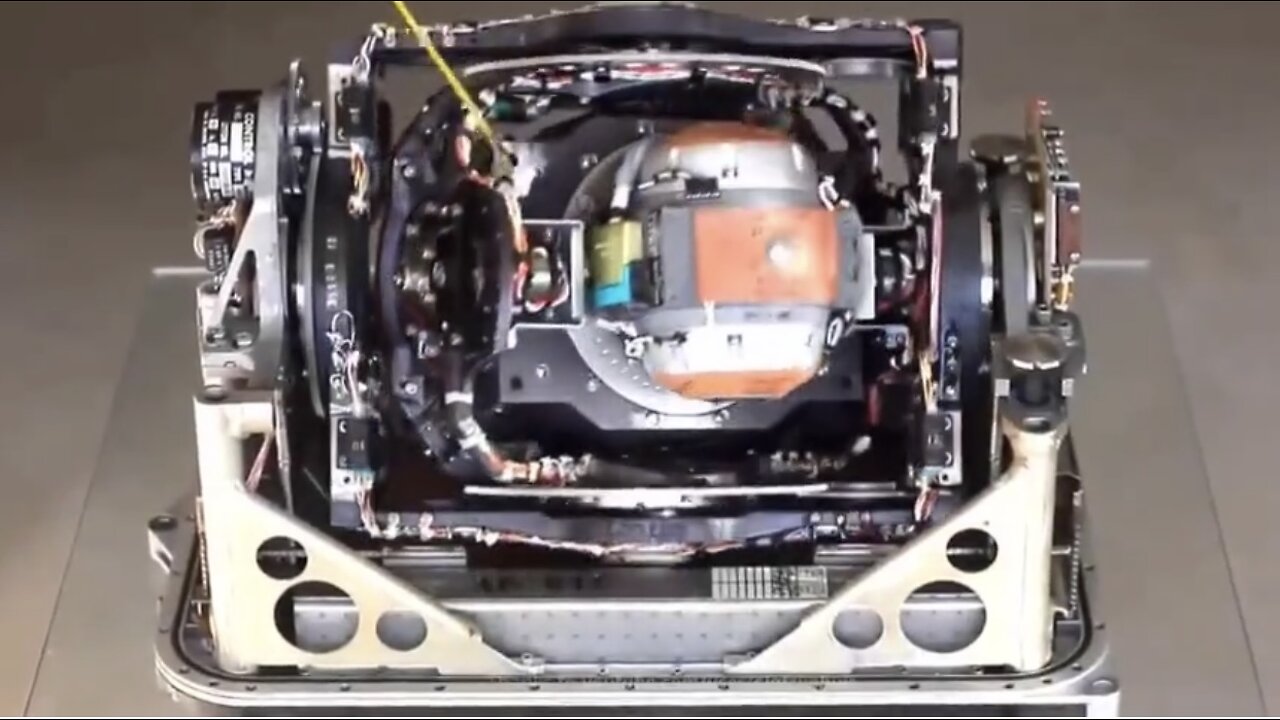
Inertial Navigation System
Repost
7 months ago
63
Developed in 1960s, the INS (Inertial Navigation Systems) was a collection of extremely precise accelerometers and gyroscopes, used to calculate and display an object’s position, speed and direction relative to a known starting point. eg. Once an aircraft's or submarine’s INS is calibrated to a known reference point, it can “dead reckon” the target accurately from that point forward. The earlier INS did not take into account the curvature of the Earth and pilots could still navigate using this basic navigation system.
Loading 1 comment...
-
 5:43:44
Scammer Payback
2 days agoCalling Scammers Live
174K25 -
 18:38
18:38
VSiNLive
2 days agoProfessional Gambler Steve Fezzik LOVES this UNDERVALUED Point Spread!
130K17 -
 LIVE
LIVE
Right Side Broadcasting Network
10 days agoLIVE REPLAY: President Donald J. Trump Keynotes TPUSA’s AmFest 2024 Conference - 12/22/24
3,735 watching -
 4:31
4:31
CoachTY
1 day ago $27.33 earnedCOINBASE AND DESCI !!!!
176K11 -
 10:02
10:02
MichaelBisping
1 day agoBISPING: "Was FURY ROBBED?!" | Oleksandr Usyk vs Tyson Fury 2 INSTANT REACTION
98.2K14 -
 8:08
8:08
Guns & Gadgets 2nd Amendment News
2 days ago16 States Join Forces To Sue Firearm Manufacturers Out of Business - 1st Target = GLOCK
121K90 -
 10:17
10:17
Dermatologist Dr. Dustin Portela
2 days ago $18.76 earnedOlay Cleansing Melts: Dermatologist's Honest Review
157K14 -
 1:02:20
Trumpet Daily
2 days ago $48.56 earnedObama’s Fake World Comes Crashing Down - Trumpet Daily | Dec. 20, 2024
112K70 -
 6:29
6:29
BIG NEM
1 day agoCultivating God Mode: Ancient Taoist NoFap Practices
81.6K20 -
 30:53
30:53
Uncommon Sense In Current Times
2 days ago $11.76 earned"Pardon or Peril? How Biden’s Clemency Actions Could Backfire"
92.6K10