Inertial Navigation System
1 year ago
66
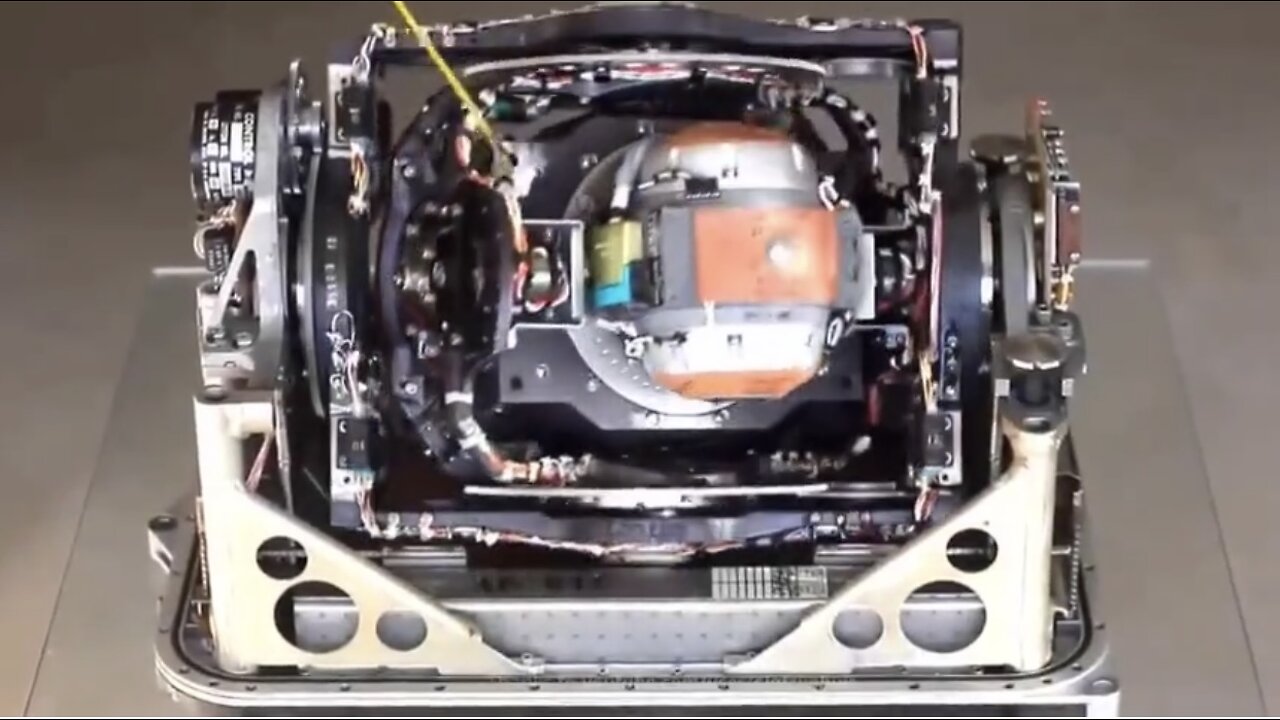
Developed in 1960s, the INS (Inertial Navigation Systems) was a collection of extremely precise accelerometers and gyroscopes, used to calculate and display an object’s position, speed and direction relative to a known starting point. eg. Once an aircraft's or submarine’s INS is calibrated to a known reference point, it can “dead reckon” the target accurately from that point forward. The earlier INS did not take into account the curvature of the Earth and pilots could still navigate using this basic navigation system.
Loading 1 comment...
-
 LIVE
LIVE
GrimmHollywood
2 hours ago🔴LIVE • GRIMM HOLLYWOOD • SGT WILKY'S WARZONE PALOOZA 2 •
72 watching -
 20:36
20:36
It’s the Final Round
2 hours ago $2.49 earnedNBA Best Bets & Player Props | Full Analysis & Predictions, FREE Today (Saturday 11/9) November 9th
11.5K1 -
 LIVE
LIVE
The Real Tombliboos - Live Streaming
13 hours ago $0.51 earned🎮 Charity Stream for Extra Life 4 Kids! ❤ Supporting Texas Children’s Hospital ! 🙌
100 watching -
 LIVE
LIVE
Amarok_X
3 hours ago🟢LIVE | BF6 REDSEC | OPERATION 100 FOLLOWERS | VETERAN GAMER
18 watching -
 18:08
18:08
Professor Nez
4 hours ago⚠ Charlie Kirk WARNED America about Zohran Mamdani
12.1K47 -
 LIVE
LIVE
GritsGG
2 hours ago#1 Most Warzone Wins 3943+!
24 watching -
 LIVE
LIVE
FusedAegisTV
5 hours agoFUSEDAEGIS | Generational Video Game?? | Expedition 33 PART I
30 watching -
 DVR
DVR
FoeDubb
2 hours ago🏰KINGDOM MENU: 🎮💻🎤FRIDAY NITE VIBES ON DECK DILLY DILLY!!!
264 -
 2:16:26
Megyn Kelly
23 hours agoBen Shapiro Responds to Tucker Carlson, Plus Sydney Sweeney and Newsom, with Knowles and Klavan
92.8K228 -
 2:10:39
LFA TV
1 day agoRUMBLE RUNDOWN WEEK 5 with JEREMY HERRELL AND SHAWN FARASH 11.8.25 9AM
141K22