Michael Fish's NBC26 Storm Shield weather forecast
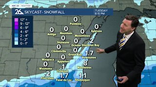
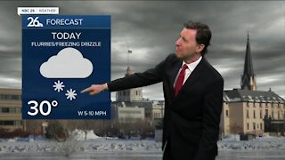
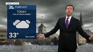
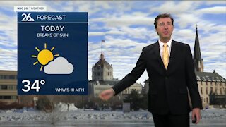
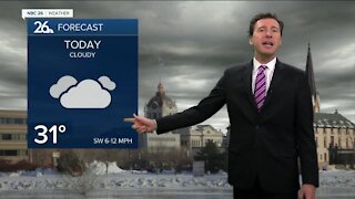
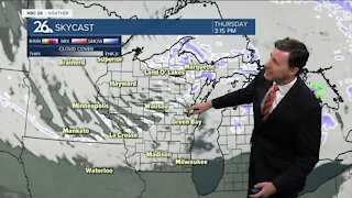
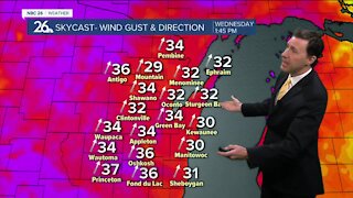
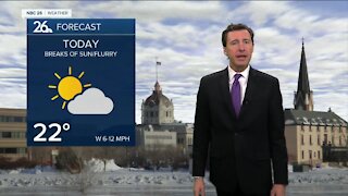
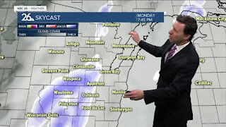
Yes, you read that correctly. A compact area of low pressure will quickly track through the area on Wednesday with some afternoon and evening snow or mix, especially the farther south you live. This will be nothing like we just saw, but still could bring us 1-3" with the higher totals the farther south you live, and almost nothing well north. If you live toward Green Lake, Marquette or Waushara, this could be a 2-4" snow for you. Let's enjoy the little break today, Speaking of which, today we'll have a little more sun which will help melt a little bit of the snow, but it still will be much cooler than average. Highs will top out in the upper-30s. Tuesday night also looks quiet with lows in the mid-20s. Wednesday, there will be that good chance of snow or a wintry mix as we head through the afternoon into the evening. Highs will top out in the close to 40. Some accumulations are likely....right now it looks like a 1-3"/2-4"snowfall with the highest totals to the SW. Again, nothing compared to what we just saw. Late Wednesday night this all should be done with lows in the upper-20s. Here comes the sun for Thursday with milder temperatures. Highs will be in the mid-40s. After that, things look quiet with moderating temps into next weekend.
-
 1:57
1:57
WGBA
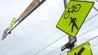
7 months agoHow the City of Green Bay is hoping a $1.6M investment will make the community safer for pedestrians
901 -
 2:20
2:20
WGBA
3 years agoMichael Fish's NBC 26 weather forecast
14 -
 2:21
2:21
WGBA
3 years agoMichael Fish's NBC 26 weather forecast
6 -
 2:11
2:11
WGBA
3 years agoMichael Fish's NBC 26 weather forecast
4 -
 1:50
1:50
WGBA
3 years agoMichael Fish's NBC 26 weather forecast
3 -
 1:45
1:45
WGBA
3 years agoMichael Fish's NBC 26 weather forecast
7 -
 3:03
3:03
WGBA
3 years agoMichael Fish's NBC 26 weather forecast
8 -
 2:33
2:33
WGBA
3 years agoMichael Fish's NBC 26 weather forecast
5 -
 2:30
2:30
WGBA
3 years agoMichael Fish's NBC 26 weather forecast
11 -
 1:54
1:54
WGBA
3 years agoMichael Fish's NBC 26 weather forecast
2