Michael Fish's NBC26 Storm Shield weather forecast
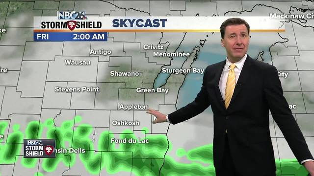
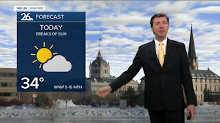
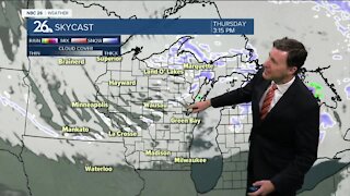
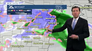
There is going to be a break in the action for our daytime hours today. Highs will top out near 50, though cooler near Lake Michigan at times. There will be a chance of rain showers later tonight or possibly a wintry mix north with lows in the mid-30s. Rain rolls in for Friday for most of us through the day with highs in the low-40s. A wintry mix is possible across the north. It'll be raw with windy conditions coming right off of Lake Michigan. This preciptiation continues into Friday night with things changing to snow across the far north, then for many of us farther south, this could change over to freezing rain at times. The only potential upside to this is the stronger sun angle at this time of year going into Saturday for anything that would accumlate melting things, especially on the roads. Saturday, there will still be some rain, freezing rain or snow at times, but this will be lighter as we will be between systems. The high sun angle will help melt things a little through the day. Highs will only top out in the low- to mid-30s. The question still remains temperatures and strength of this secondary low that starts to move in on Saturday night. Either way, a wintry mix will start to roll in as the night goes on, gradually changing over to all snow. Lows will bottom out around 30, so this will be sticking, especially without the sun. It looks like this will be all snow through the day on Sunday, before tapering off into the afternoon. The computer models still have quite a variation on how much snow would fall with this particular batch, but some of you could end up with a substantiall amount of snow. It'll also be windy, so blowing and drifting snow could be an issue. Just be aware if you have travel plans, especially north on Friday, then Saturday night/Sunday for the whole state, that could be a problem. We'll keep you updated as the latest data rolls in.
-
 3:36
3:36
WGBA
1 year agoWill it be necessary to have both the AC & the heat on during the same day??
3831 -
 2:21
2:21
WGBA
4 years agoMichael Fish's NBC 26 weather forecast
6 -
 2:11
2:11
WGBA
4 years agoMichael Fish's NBC 26 weather forecast
4 -
 1:50
1:50
WGBA
4 years agoMichael Fish's NBC 26 weather forecast
3 -
 1:45
1:45
WGBA
4 years agoMichael Fish's NBC 26 weather forecast
7 -
 3:03
3:03
WGBA
4 years agoMichael Fish's NBC 26 weather forecast
8 -
 2:33
2:33
WGBA
4 years agoMichael Fish's NBC 26 weather forecast
5 -
 2:30
2:30
WGBA
4 years agoMichael Fish's NBC 26 weather forecast
11 -
 1:54
1:54
WGBA
4 years agoMichael Fish's NBC 26 weather forecast
2 -
 2:32
2:32
WGBA
4 years agoMichael Fish's NBC 26 weather forecast
10