Michael Fish's NBC26 Storm Shield weather forecast
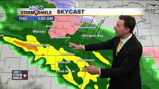
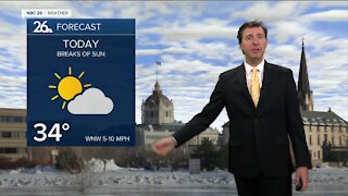
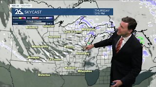
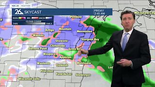
Today, will finally be a decent day on the temperature front, unless you live near Lake Michigan this afternoon. A stronger area of low pressure will approach the area, but mainly not until the evening. We'll finally have temperatures closer to average with highs around 50, though becoming a bit cooler lakeside. Rain(some snow north) rolls into the area on tonight as winds switch back to the ESE. There will be a break in the action on Thursday with around 50 again, though becoming cooler near Lake Michigan. There will be a chance of rain, possibly mixed with snow, later Thursday night with lows in the mid-30s. Rain rolls in for Friday for most of us through the day with highs in the low-40s. A wintry mix is possible across the north. It'll be raw with windy conditions coming right off of Lake Michigan. A strong area of low pressure may roll through during the weekend. This one really bears watching, especially with the stronger secondary low pressure system for Sunday. If this verifies with the cooler modeled temperatures, we could end up with snow that we'd have to shovel. Just be aware if you have travel plans, especially north on Friday, then also Sunday for the whole state, that could be a problem. We'll keep you updated as the latest data rolls in.
-
 1:45
1:45
WGBA
1 year agoStudents excited to start at "huge and beautiful" Vel Phillips Middle School
369 -
 2:21
2:21
WGBA
4 years agoMichael Fish's NBC 26 weather forecast
6 -
 2:11
2:11
WGBA
4 years agoMichael Fish's NBC 26 weather forecast
4 -
 1:50
1:50
WGBA
4 years agoMichael Fish's NBC 26 weather forecast
3 -
 1:45
1:45
WGBA
4 years agoMichael Fish's NBC 26 weather forecast
7 -
 3:03
3:03
WGBA
4 years agoMichael Fish's NBC 26 weather forecast
8 -
 2:33
2:33
WGBA
4 years agoMichael Fish's NBC 26 weather forecast
5 -
 2:30
2:30
WGBA
4 years agoMichael Fish's NBC 26 weather forecast
11 -
 1:54
1:54
WGBA
4 years agoMichael Fish's NBC 26 weather forecast
2 -
 2:32
2:32
WGBA
4 years agoMichael Fish's NBC 26 weather forecast
10