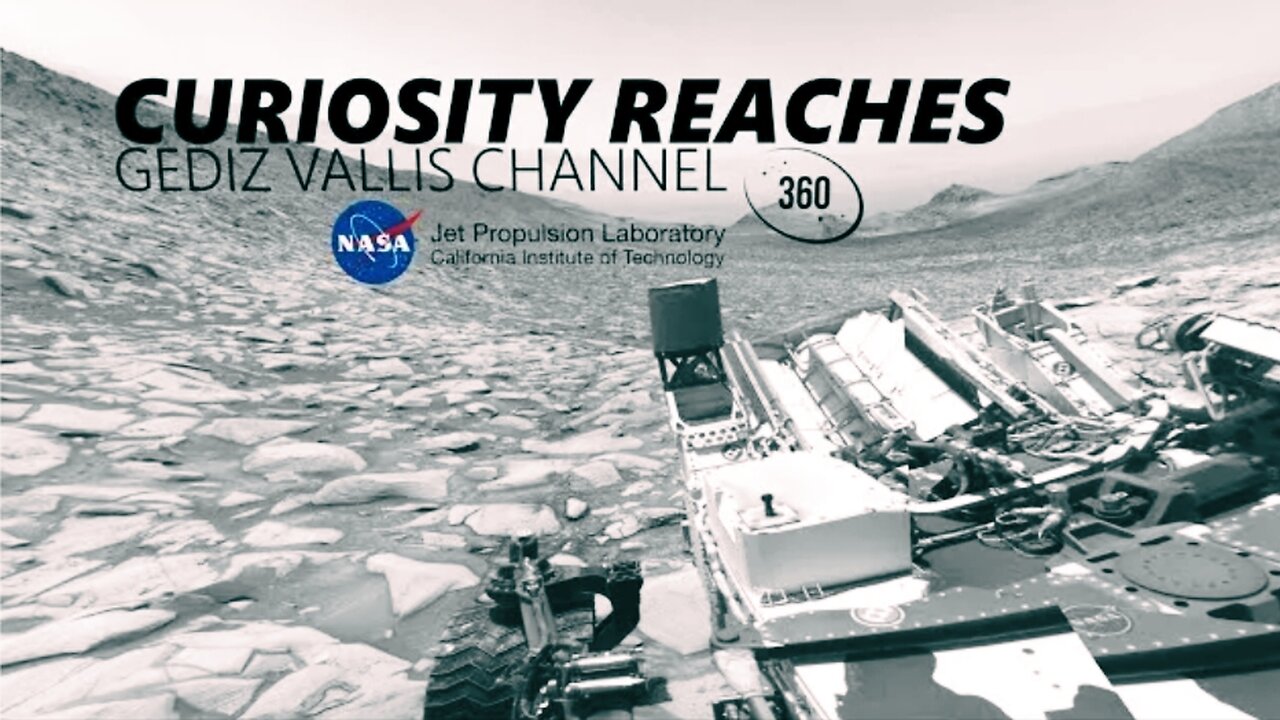
360-degree panorama provided by NASA's Curiosity Mars rover
distance you can trace the tops of the natural levees that formed at the near and far banks of the river. The rover will pass this area on its way upstream, continuing toward this spot where the river carved through the crater wall. You can see the canyon on the horizon here.
From there, Perseverance will be well positioned to head south and ascend this natural ramp that leads up and out of the crater. We’re lucky to have a route the rover can safely drive up the rim right where we need it.
Starting the climb would mark a new and exciting phase of the mission: exploring rocks far older than those in Jezero and produced in an entirely different way. One tempting target are these light-colored rocks partway up the rim. They may have interacted with hot water in a hydrothermal environment – another exciting place to hunt for evidence of past life.
Since finishing its study of the crater floor, Perseverance has been climbing the delta and piecing together the history of this once-watery environment. We've come a long way in nearly three years of exploring and collecting samples. But there’s still so much more to investigate. Follow the journey at mars.nasa.gov/perseverance.
-
 LIVE
LIVE
The Mel K Show
1 hour agoLive Q&A with Mel K 8-27-25
322 watching -
 LIVE
LIVE
Quite Frankly
5 hours ago"Planet Chaos, Life on Mars, Open Lines" ft. Oppenheimer Ranch Project 8/27/25
473 watching -
 LIVE
LIVE
The Mike Schwartz Show
6 hours agoTHE MIKE SCHWARTZ SHOW Evening Edition 08-27-2025
155 watching -
 1:34:24
Redacted News
3 hours agoLIVE: Minnesota School Shooter’s Shocking Motive Revealed – Plus Trump Targets Soros w AG Ken Paxton
122K131 -
 4:55:15
StoneMountain64
6 hours agoHUNTING FOR THE FIRST WIN BACK ON WARZONE
58.6K2 -
 1:09:06
The Officer Tatum
4 hours agoBREAKING: Shooter IDENTIFIED TR*NS , Cracker Barrel CAVES To Pressure + MORE | EP 162
37K66 -
 53:47
53:47
Matt Kohrs
4 hours agoLIVE! Nvidia Earnings Call || NVDA Stock Reaction
31.3K1 -
 32:25
32:25
Tudor Dixon
2 hours agoKarol Markowicz on Freedom, Immigration, and Saving the American Dream | The Tudor Dixon Podcast
6.77K -
 2:03:25
The Quartering
6 hours agoFlag Burning, Free Speech, Church Attack & More With Andrew Wilson
203K314 -
 3:02:42
The Robert Scott Bell Show
20 hours agoDr. Peter McCullough, Vaccines: Mythology, Ideology, and Reality, Dr. Dan Sullivan, Chiropractic - The RSB Show 8-27-25
27.9K1