Michael Fish's NBC26 Storm Shield weather forecast
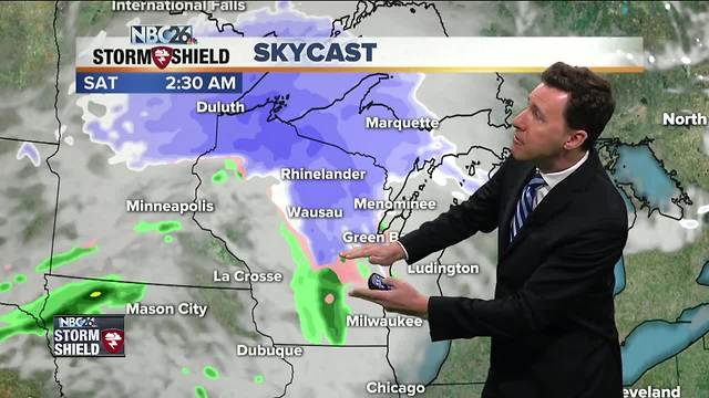
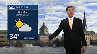
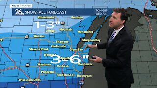
A cool front has been working its way through the area, but it has been doing so fairly quietly. if there's a stray morning sprinkle or flurry, don't be surprised, but most of us for most of the day will stay dry. We'll have more and more sun as the day goes on, but it will get a bit breezy. Highs should top out in the mid-40s behind the front. Tonight will be quiet with mostly clear skies and lows in the mid-20s. Friday, there's a slight chance of some precipitation in the afternoon, but that won't be the main system we're watching. Highs will top out in the mid-40s. There is still uncertainty with the system for late Friday night into the weekend. Right now it's becoming more of a "track" issue. Either way, the way it looks right now, since it's going to start at night, it should be cold enough to have everything start out as snow, mainly late Friday night. Many of us will end up with some accumulation by Saturday morning with the highest totals north. This snow will continue on Saturday morning to the north, but most likely change to some rain the farther south you go. It's going to be a windy day with highs in the low-40s, but cooler readings to the north where there should be more snow. Get ready for a cold Easter Sunday with highs only in the low-30s.
-
 0:30
0:30
WGBA
1 year agoThree Degree Guarantee
261 -
 2:11
2:11
WGBA
4 years agoMichael Fish's NBC 26 weather forecast
4 -
 1:50
1:50
WGBA
4 years agoMichael Fish's NBC 26 weather forecast
3 -
 1:54
1:54
WGBA
4 years agoMichael Fish's NBC 26 weather forecast
2 -
 1:39
1:39
WGBA
4 years agoMichael Fish's NBC 26 weather forecast
2 -
 2:27
2:27
WGBA
4 years agoMichael Fish's NBC 26 weather forecast
5 -
 2:32
2:32
WGBA
4 years agoMichael Fish's NBC 26 weather forecast
2 -
 2:22
2:22
WGBA
4 years agoMichael Fish's NBC 26 weather forecast
5 -
 2:19
2:19
WGBA
4 years agoMichael Fish's NBC 26 weather forecast
3 -
 2:34
2:34
WGBA
4 years agoMichael Fish's NBC 26 weather forecast
3