Michael Fish's NBC26 Storm Shield weather forecast
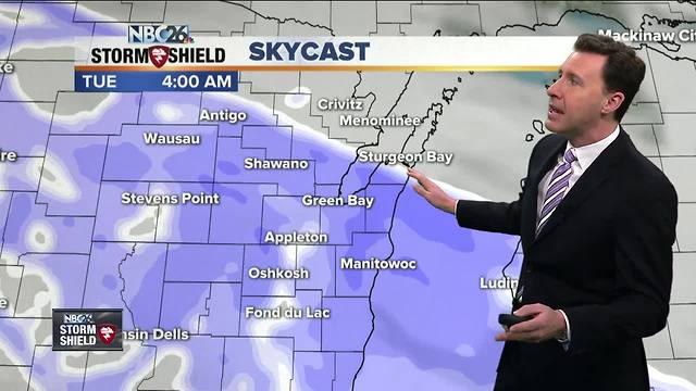
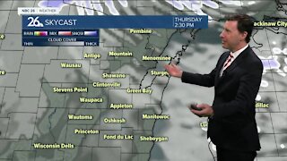
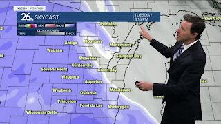
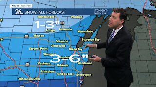
The daytime hours today will be dry and blustery with highs in the upper-30s. You'll see clouds on the increase, but the main weather-maker doesn't get here until tonight. Your evening commute actually looks fine for most of us, but things go downhill as the evening wears on. Snow will be developing from the SW and quickly filling in between 9PM-Midnight. This will continue throughout the night. By the time you wake up, expect about 2-4" of snow on the ground with lesser totals to the north. It'll be blustery blowing some of this snow around in rural areas. Lows will bottom out in the upper-20s. Areas of snow will continue on Tuesday, but there will be more breaks. Another 1-3" of snow are possible with the higher totals near the lake and lesser amounts to the north. That gives us a general 4-6", 5-7" possible near Lake Michigan and 2-4" well north. It'll still be blustery with highs in the mid-30s. We could see a couple snow showers on Tuesday night, but that tapers off as the night wears on. Lows will be colder bottoming out around 20. Wednesday should be a quiet, but breezy day with highs in the low-30s. Dry weather continues then into the upcoming weekend the way things look at the moment.
-
 1:57
1:57
WGBA
1 year agoHow the City of Green Bay is hoping a $1.6M investment will make the community safer for pedestrians
4742 -
 1:39
1:39
WGBA
4 years agoMichael Fish's NBC 26 weather forecast
2 -
 2:32
2:32
WGBA
4 years agoMichael Fish's NBC 26 weather forecast
2 -
 2:22
2:22
WGBA
4 years agoMichael Fish's NBC 26 weather forecast
24 -
 2:19
2:19
WGBA
4 years agoMichael Fish's NBC 26 weather forecast
3 -
 2:34
2:34
WGBA
4 years agoMichael Fish's NBC 26 weather forecast
7 -
 2:42
2:42
WGBA
4 years agoMichael Fish's NBC 26 weather forecast
1 -
 1:52
1:52
WGBA
4 years agoMichael Fish's NBC 26 weather forecast
5 -
 2:35
2:35
WGBA
4 years agoMichael Fish's NBC 26 weather forecast
2 -
 1:42
1:42
WGBA
4 years agoMichael Fish's NBC 26 weather forecast
10