FULL HIKE ALTERNATE ROUTE to Dry Creek Falls! | 4K Columbia River Gorge National Scenic Area Oregon
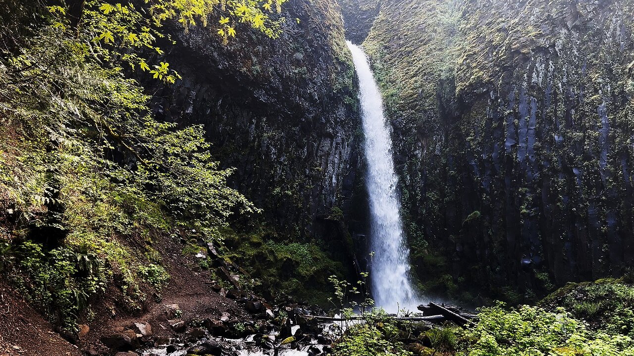
This was a Day-Hike, Columbia River Gorge National Scenic Area in Oregon, hiking to Dry Creek Falls. The main approach is typically via the Pacific Crest Trail, approximately 4.4 miles, 900 FT Elevation Gain. However, really due more to an accident/mistake of typing the location into Google Maps too quickly as I was trying to jam in 5 - 6 separate hikes in a row, I drove to Dry Creek Road, and accessed the area slightly to the North of the typical Pacific Crest Trailhead by hiking up a Forest Road Fire Line. This cut the hike from 4.4 miles to 3 miles, and cut a couple hundred feet of Elevation Gain. I also liked that this Forest Road more closely paralleled Dry Creek and I was the only one on that side on a busy day. The down side was that the Forest Road was a bit sketchy and bumpy, not all cars would make it, most likely would if driving very slowly and cautiously and prudently, but attempt to do so only at your own risk!
One of the things I like about Dry Creek Falls area is that it has that Wilderness Adventuring feel of a muddy/dirt trail in the Rainforest, whereas several of the other popular Hikes in the area are more paved cement/asphalt the entire way with that touristy feel. so this one had more of a natural wild rustic feel which I personally enjoy and appreciate.
This was hiked on 5/20/22, the weather was inconsistent, some sun breaks, blue sky, clouds and overcast, with a low in the high 30's and a high in the 50's, and there were NO mosquitoes.
-
 5:45
5:45
HikingViking
9 days agoFULL WINTER SNOWSHOE HIKE 4K Elk Meadows Trail to Clark Creek Bridge! | Mount Hood Wilderness Oregon
741 -
 1:18:19
Glenn Greenwald
8 hours agoRumble & Truth Social Sue Brazil’s Chief Censor Moraes in US Court; DC Establishment Melts Down Over Trump's Ukraine Policy | SYSTEM UPDATE #409
97K107 -
 1:33:39
Redacted News
10 hours agoBREAKING! Europe goes NUCLEAR against Trump over pushing for PEACE in Ukraine | Redacted
178K218 -
 1:00:43
The StoneZONE with Roger Stone
6 hours agoRoger Stone Destroys Mike Pence for Attacks on Trump | The StoneZONE
102K37 -
 1:05:43
Flyover Conservatives
1 day agoFederal Reserve on the Chopping Block—Trump’s Boldest Move Yet! - Floyd Brown, Western Journal | FOC Show
55.1K5 -
 2:50:40
Melonie Mac
12 hours agoGo Boom Live Ep 38!
50.8K3 -
 11:08
11:08
China Uncensored
10 hours agoXi Jinping's Greatest Fear
29K10 -
 2:11:20
I_Came_With_Fire_Podcast
15 hours agoFar Left TROJAN HORSE | SPECIAL Forces in MEXICO | GERMANY under FIRE
23K13 -
 1:41:00
Darkhorse Podcast
12 hours agoIf Only We’d Known: The 265th Evolutionary Lens with Bret Weinstein and Heather Heying
153K36 -
 1:58:29
Conspiracy Pilled
3 days agoThe Vaccine Conversation (S5 - Ep17)
65K2