
Michael Fish's NBC26 Storm Shield weather forecast
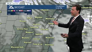
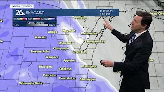
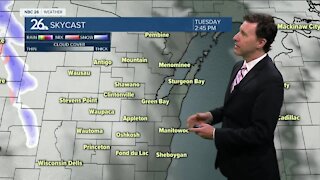
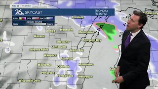
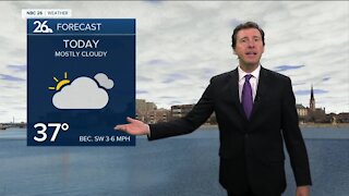
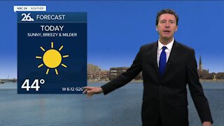
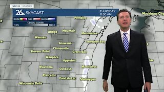
Today will be quiet, but cooler than yesterday. NE winds off of Lake Michigan and The Bay will cool it down even more there, but inland, we should make it into the lower- to mid-40s. The next system will be on the way for late tonight bringing us a chance of a light wintry mix, but nothing major. Lows will bottom out in the upper-20s. There still is some uncertainty with the forecast for Thursday. Either way, as of right now, there looks to be a fairly good chance of some snow, but it does NOT appear heavy at this time. Another question mark will be how will it accumulate with the milder ground temperatures and the sun's strength, even behind the clouds. We also may mix in some rain to the south. As of right now, I'm going to go with 1-2" along and south of HWY 29 and only a Tr.-1" north of there. Highs will top out in the mid-30s during the daytime hours. If there's any lingering snow on Thursday evening, that will move out, then we'll clear out the skies. Lows will bottom out in the mid-20s. If we do see any accumulating snow with that system, we'll be melting most of it on Friday with mostly sunny skies and highs around 40. The weekend looks mild and quiet with mostly sunny skies and temperatures in the 40s. We probably will see some rain and snow at times Monday and Tuesday of this upcoming week.
-
 1:57
1:57
WGBA
1 year agoHow the City of Green Bay is hoping a $1.6M investment will make the community safer for pedestrians
4392 -
 1:39
1:39
WGBA
4 years agoMichael Fish's NBC 26 weather forecast
2 -
 2:32
2:32
WGBA
4 years agoMichael Fish's NBC 26 weather forecast
2 -
 2:34
2:34
WGBA
4 years agoMichael Fish's NBC 26 weather forecast
3 -
 2:42
2:42
WGBA
4 years agoMichael Fish's NBC 26 weather forecast
1 -
 1:52
1:52
WGBA
4 years agoMichael Fish's NBC 26 weather forecast
5 -
 2:35
2:35
WGBA
4 years agoMichael Fish's NBC 26 weather forecast
2 -
 1:42
1:42
WGBA
4 years agoMichael Fish's NBC 26 weather forecast
10 -
 2:05
2:05
WGBA
4 years agoMichael Fish's NBC 26 weather forecast
4 -
 2:26
2:26
WGBA
4 years agoMichael Fish's NBC 26 weather forecast
5