Michael Fish's NBC26 Storm Shield weather forecast
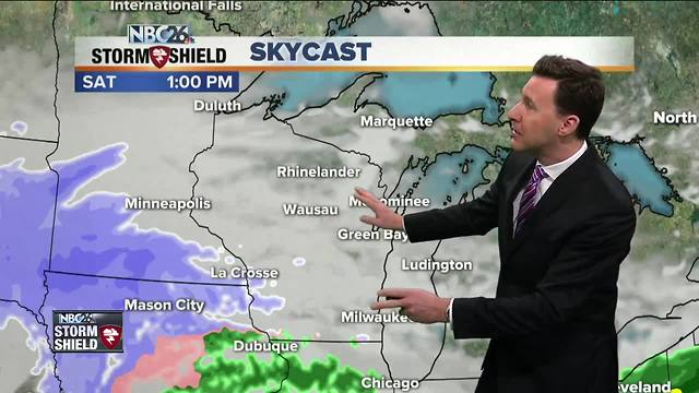
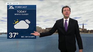
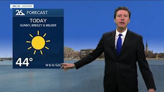
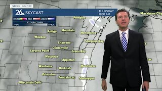
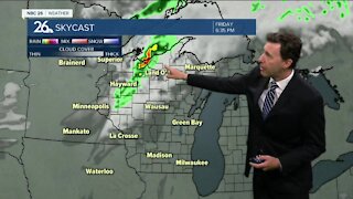
This wintry mix of light snow, freezing rain, rain and sleet tapers off this morning. The problem was the nighttime pavement temperatures that where temperatures are above freezing in many spots, the rain has been freezing on the cold pavement. Highs today will be popping back up into the low-40s so we will be melting any wintry accumulation. Tonight will be partly cloudy at times and quiet. Lows will be in the low-40s. Saturday, a stronger low pressure will be approaching the area, with the chance of precipitation increasing, but as of right now, the bulk of this would fall at night. Daytime highs on Saturday will be around 40 with breezy conditions. For many of us, this looks to fall as mainly rain, but could change over to a wintry mix later at night. If you live off to the N and NW some of this will fall as snow, and you probably will end up with 1-3" with 3-5" possible well off to the NW. Lows will be in the low-30s. Most of that precipitation should be out of here by Sunday morning. We will also see strong westerly winds with gusts over 35 mph. Temps will stay above normal into March.
-
 1:57
1:57
WGBA
1 year agoHow the City of Green Bay is hoping a $1.6M investment will make the community safer for pedestrians
4742 -
 1:39
1:39
WGBA
4 years agoMichael Fish's NBC 26 weather forecast
2 -
 2:34
2:34
WGBA
4 years agoMichael Fish's NBC 26 weather forecast
7 -
 2:42
2:42
WGBA
4 years agoMichael Fish's NBC 26 weather forecast
1 -
 1:52
1:52
WGBA
4 years agoMichael Fish's NBC 26 weather forecast
5 -
 2:35
2:35
WGBA
4 years agoMichael Fish's NBC 26 weather forecast
2 -
 1:42
1:42
WGBA
4 years agoMichael Fish's NBC 26 weather forecast
10 -
 2:05
2:05
WGBA
4 years agoMichael Fish's NBC 26 weather forecast
4 -
 2:26
2:26
WGBA
4 years agoMichael Fish's NBC 26 weather forecast
5 -
 2:00
2:00
WGBA
4 years agoMichael Fish's NBC 26 weather forecast
5