
Michael Fish's NBC26 Storm Shield weather forecast
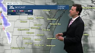
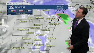
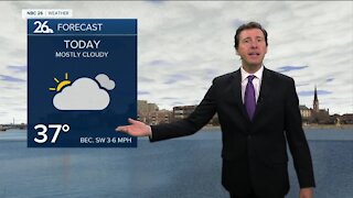
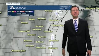
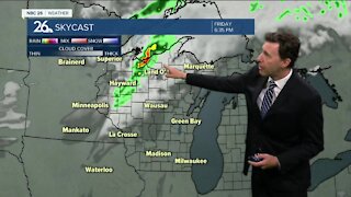
We have significant icing on the way for parts of Northeast Wisconsin. We have not had anything of this nature so far this season. This will come in two, separate waves with the first one starting mainly this afternoon for most. We will see the first, main batch of a wintry mix of sleet, snow and freezing rain develop mainly this afternoon. The farther you live north, the more this will just be mainly snow. Our high temps will top out in the mid-30s, but start to fall back below freezing as the afternoon wears on. With a mild layer aloft, precip will be falling as liquid for many, but hitting things that are at or below the freezing mark. In these scenarios, just 1 degree can make a huge difference. Keep in mind that this forecast could change. This freezing rain mixed with snow to the north will continue through the evening before round 1 tapers off later. Temperatures will stay below freezing in the upper-20s, so any ice accumulation will persist through the night. It will be breezy, so anything laden with ice might be impacted by the wind. Round 2 will get here close to the early morning hours again. Any snow to the north would only amount to 1-2". Another round of freezing rain, sleet and even some rain will work its way through tomorrow morning, but as temperatures moderate to above freezing through the morning, any precip would change over to mainly rain closer to the noon hour. Should these temperatures pop above freezing as forecast, this would help melt any ice accumulation. The potential exists for some folks to get over 0.25" of ice accumulation which would have an impact on roads, trees and power lines. Again, as temperatures rise above freezing, we should start to melt some of the accumulated ice in many locations. Highs will top out in the mid- to upper-30s. There might be a little lingering, mixed wintry precip on Tuesday night, but the bulk of the activity should be done. Lows will bottom out in the upper-teens. Though we'll probably be below freezing on Wednesday, the stronger sunshine may do some additional melting of any leftover ice even with a high around 30.
-
 1:45
1:45
WGBA
1 year agoFond du Lac Cardinals start the football season with a new $5.3 million nest
360 -
 2:34
2:34
WGBA
4 years agoMichael Fish's NBC 26 weather forecast
3 -
 2:42
2:42
WGBA
4 years agoMichael Fish's NBC 26 weather forecast
1 -
 1:52
1:52
WGBA
4 years agoMichael Fish's NBC 26 weather forecast
5 -
 2:35
2:35
WGBA
4 years agoMichael Fish's NBC 26 weather forecast
2 -
 1:42
1:42
WGBA
4 years agoMichael Fish's NBC 26 weather forecast
10 -
 2:05
2:05
WGBA
4 years agoMichael Fish's NBC 26 weather forecast
4 -
 2:26
2:26
WGBA
4 years agoMichael Fish's NBC 26 weather forecast
5 -
 2:00
2:00
WGBA
4 years agoMichael Fish's NBC 26 weather forecast
5 -
 2:30
2:30
WGBA
4 years agoMichael Fish's NBC 26 weather forecast
2