Premium Only Content

SILENT PERSPECTIVES of Timothy Lake! | 4K | Mount Hood National Forest | Oregon
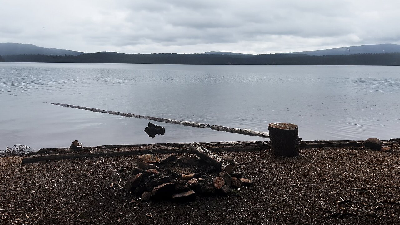
The following is a 4K Video Clip Compilation of 16 Silent Clips of Different Perspectives of Timothy Lake. All clips are original, no clip appears twice.
Timothy Lake is one of the crown jewels of the Mount Hood Area. There are 7 Developed Campgrounds along the Lake as well as 41 FREE Dispersed Backcountry Campsites (marked T1 - T40, strongly recommend downloading a FREE PDF at PortlandGeneral.com for precise locations), and a highly premium Backcountry Camping Area called Meditation Point with 7 Campsites on a Shoreline Peninsula, each site is $10 per Night (as of Feb 2024), no Reservations, First Come, First Served. Of the 7 Developed Campgrounds, the main campground row is the South side of the Lake. Each Campground is very well built out and maintained, with boat ramp/launch, a rich plethora of Day Use Picnic Sites too innumerable to count, and outstanding signage for an interconnected intricate trail system that helps facilitate the 13 Mile Shoreline Circumnavigation Hike that goes all the way around Timothy Lake. I have organized the Videos as follows:
- Oak Fork Campground (Boat Launch + Day Use Areas + Best Campsites)
- Gone Creek Campground (Boat Launch + Day Use Areas + Best Campsites)
- Hoodview Campground (Boat Launch + Day Use Areas + Best Campsites)
- Top 8 Countdown of the Best Campsites across all Developed Campgrounds
- Reviewing Each Campsite at Meditation Point, Backcountry Camping Peninsula
- Ranking Each Campsite at Meditation Point, Backcountry Camping Peninsula
- Southshore Day Use Area to T1 - T4 (to give a taste of the dispersed backcountry camping)
- Videos highlighting "The Cove" Day Use Area
- Videos highlighting Pine Point Day Use Area
- Silent Perspectives 4K Compilation of Timothy Lake
- Little Crater Lake Area and Flooding Causing Me to Turnaround
- Several Shoreline Hiking Videos capturing the gorgeous Shoreline Perspective
This was a Day-Hike in Oregon, Mount Hood National Forest, Timothy Lake Area, attempting to circumnavigate the approximately 13 Mile Shoreline Loop all the way around Timothy Lake. I attempted to start at Little Crater Lake, however the planked swampy section was flooded, so I got back in my car and re-launched my Hike at "The Cove" Day Use Area instead. I hiked the 13 Mile Shoreline Circumnavigation Hike with an emphasis on the Campgrounds.
The elevation starts around 3200 FT and is a relatively flat area with some natural machinations in the Forest Trail, less than a 1000 FT overall Elevation Gain. The sky was dark grey clouds, mostly overcast, foggy and misty and it rained off and on in spurts.
This was hiked on 5/25/2022, two days before the official start of the season on 5/27/2022 aka Memorial Day Weekend, and there were NO Mosquitoes. I would recommend doing this hike the week before Memorial Day as I did or the last week of the season in September if you want a more private and secluded experience.
As far as road conditions, it's highway and well paved roads until the parking lots of course depending on where you decide to launch to do the 13 Mile Lake Loop, so it was a very easy and safe driving route. In my opinion, the road most definitely DOES NOT require 4-Wheel Drive, however do watch for road conditions, particularly snow/ice depending on the time of year, and be aware you should go slow and drive around the few last remaining small patches of snow on the road if you go in May like I did, and do so at your own risk!
-
 9:27
9:27
HikingViking
10 days ago(4K UHD) 3 LARGE GROUP CAMPSITES @ Horseshoe Cove Campground! | Baker Lake | Mt. Baker-Snoqualmie NF
401 -
 LIVE
LIVE
Akademiks
1 hour agoWar in RAT-LANTA. Young Thug vs Gunna vs Ralo vs YSL MONDO. Who Will Le Bebe Pick. FINAL CRASHOUT!
6,168 watching -
 17:54
17:54
Nate The Lawyer
2 hours agoChicago Mayor’s $600M Migrant Spending Leaves City $1.1B Budget CRISIS.
1203 -
 UPCOMING
Jeff Ahern
24 minutes agoThe Saturday show with Jeff Ahern
1 -
 LIVE
LIVE
DynastyXL
7 hours ago🔴LIVE: Fortnite The Comeback Stream Starts Here🎃
152 watching -
 LIVE
LIVE
BrightGaming
1 hour agoDragon Warrior 1 (NES): Defeat the DragonLord & Save the Kingdom as Erdrick's Heir with BrightGaming
959 watching -
 19:15
19:15
Stephen Gardner
18 hours ago🟢YES! Trump did it! + Elon Musk DROPS BOMBSHELL on Democrat Party!
110K210 -
 29:24
29:24
Afshin Rattansi's Going Underground
1 day agoEx-CIA Advisor & Afshin Rattansi Have HEATED Exchange Over Ukraine Proxy War
3.21K32 -
 1:06:17
Mike Rowe
20 hours agoThe Mastermind Behind THIS Radical Idea At WSU Tech | Sheree Utash #448 | The Way I Heard It
93.6K17 -
 1:29:13
I_Came_With_Fire_Podcast
13 hours agoAncient Egypt's Tech & the Secret Temples of Malta
17.2K2