Michael Fish's NBC26 Storm Shield weather forecast
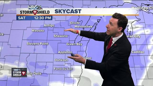
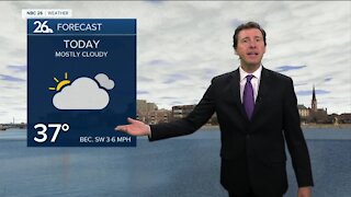
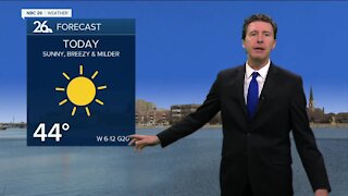
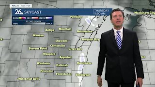
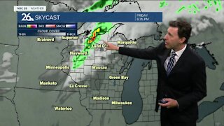
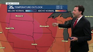
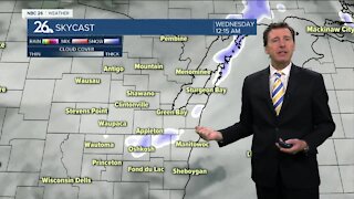
Today still looks cold, but with a little less wind. Highs will only be in the low-teens. Sunshine will slowly give way to increasing clouds late in the day. A weak system will be approaching the area as we head into Friday night. This could bring us a couple snow showers late, but that's not the main event. Lows will stay in the single-digits & teens above zero. The forecast confidence for this upcoming snow event is still rather low as the computer models still haven't zeroed in on a solution, and Lake Michigan is always a wild card. We will accumulating snow as we head through Saturday. It will start from the north and overspread the rest of the area into the afternoon as the day wears on. Right now, it looks like about 1-2" by the end of the day, though maybe a little more north. Highs will top out in the low- to mid-20s. This snow continues, then shifts a little farther south as the night goes on Saturday night, then Lake Michigan starts getting involved as the winds turn NE. It looks like through the night, another 1-3" will fall with possibly some higher totals near Lake Michigan. It'll be breezy with lows around 10. After some lingering light lake effect snow Sunday morning......most of Sunday afternoon looks dry with highs in the mid-teens. Snow totals will be from 2-5", with 5-7" possible right next to Lake Michigan. Basically, this won't be a "nuisance snow," but it won't be one of our biggest snowfalls either. Again, this forecast could change as the latest data comes in. Sunday's high will only top out in the mid-teens. Monday looks cool, but dry, with highs in the mid-teens. The cool weather sticks around for most of the upcoming workweek.
-
 0:30
0:30
WGBA
1 year agoThree Degree Guarantee
234 -
 2:35
2:35
WGBA
4 years agoMichael Fish's NBC 26 weather forecast
2 -
 2:05
2:05
WGBA
4 years agoMichael Fish's NBC 26 weather forecast
4 -
 2:26
2:26
WGBA
3 years agoMichael Fish's NBC 26 weather forecast
5 -
 2:00
2:00
WGBA
4 years agoMichael Fish's NBC 26 weather forecast
5 -
 2:30
2:30
WGBA
3 years agoMichael Fish's NBC 26 weather forecast
2 -
 2:23
2:23
WGBA
3 years agoMichael Fish's NBC 26 weather forecast
4 -
 2:46
2:46
WGBA
4 years agoMichael Fish's NBC 26 weather forecast
1 -
 2:23
2:23
WGBA
4 years agoMichael Fish's NBC 26 weather forecast
1 -
 2:08
2:08
WGBA
4 years agoMichael Fish's NBC 26 weather forecast
3