Michael Fish's NBC26 weather forecast
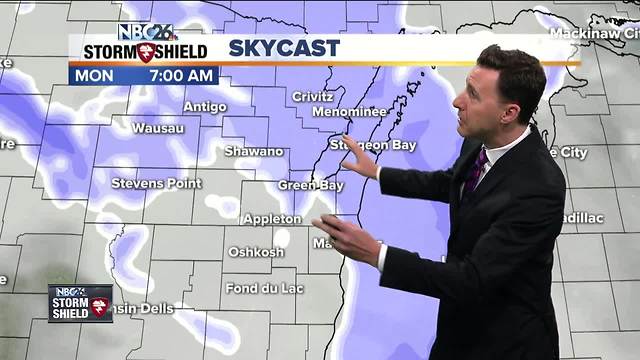
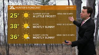
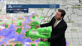
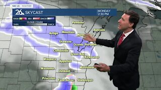
Here we go again with what I'd like to call a "nuisance snow," mainly this morning. It's not like we're going to get much, but the timing is going to be tricky for part of the morning commute, and there may be just enough that you have to clean it up. We could see only 1-2" with lesser values to the SW. The winds will NOT be strong during the snowfall so daytime blowing and drifting will NOT be a problem. This tapers off as we head into the afternoon. Highs will top out in the low-30s. Tonight, the winds will start to pick up and where there is snow, especially in the rural areas, it may start to blow around. A ***WIND ADVISORY FOR DOOR COUNTY GOES INTO EFFECT TONIGHT at 8PM until 10AM tomorrow morning.Overnight lows will be in the low-teens. Get ready for a very "winter-like" day in the temperature and wind department. It's going to be cold and blustery with highs only in the upper-teens. High temperatures on Tuesday will only make it into the middle to upper-teens with wind chills well down in the single digits. Our temps Tuesday night are going to dip all the way down into the single digits. It will still be kind of chilly on Wednesday with the chance for snow showers in the afternoon. Highs will only be in the low-20s. The chance of snow showers continues into Wednesday night as well. Thursday should be relatively quiet, though we could see a couple of flurries with highs in the upper-20s Temperatures warm up late in the week into the weekend.
-
 3:36
3:36
WGBA
1 year agoWill it be necessary to have both the AC & the heat on during the same day??
3941 -
 2:28
2:28
WGBA
4 years agoMichael Fish's NBC 26 weather forecast
2 -
 2:10
2:10
WGBA
4 years agoMichael Fish's NBC 26 weather forecast
3 -
 1:48
1:48
WGBA
4 years agoMichael Fish's NBC 26 weather forecast
4 -
 2:32
2:32
WGBA
4 years agoMichael Fish's NBC 26 weather forecast
2 -
 2:47
2:47
WGBA
4 years agoMichael Fish's NBC 26 weather forecast
5 -
 2:08
2:08
WGBA
4 years agoMichael Fish's NBC 26 weather forecast
7 -
 2:42
2:42
WGBA
4 years agoMichael Fish's NBC 26 weather forecast
3 -
 2:40
2:40
WGBA
4 years agoMichael Fish's NBC 26 weather forecast
4 -
 2:33
2:33
WGBA
4 years agoMichael Fish's NBC 26 weather forecast
2