NASA Joins Jane Goodall to Conserve Chimpanzee Habitats
Earth-observing satellites, such as Landsat, play a crucial role in monitoring and documenting environmental changes across the globe. One significant area of focus has been the shrinking habitat of chimpanzees within Africa's equatorial forest belt. The Jane Goodall Institute, a renowned organization dedicated to primate conservation, harnesses the power of Landsat and other satellite data to empower local communities in their efforts to drive conservation initiatives on their own land.
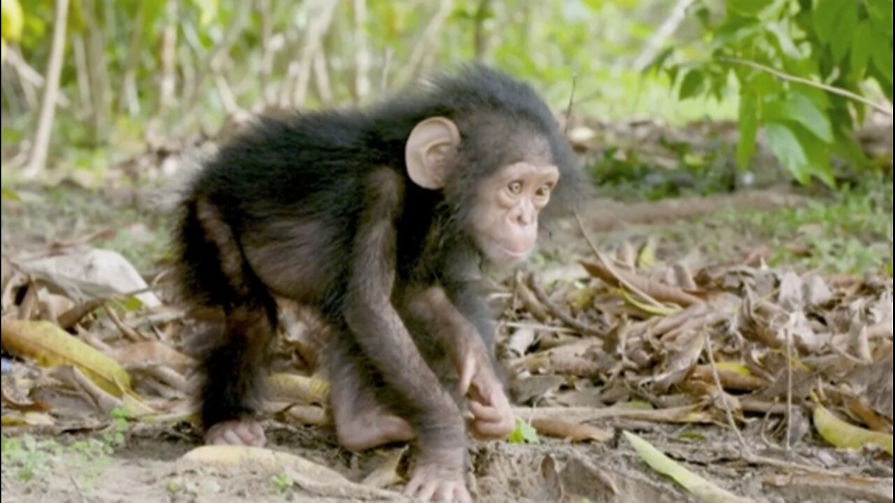
Chimpanzees, our closest living relatives in the animal kingdom, inhabit the lush and diverse equatorial forests of Africa. These habitats, however, have been under increasing threat due to various factors, including deforestation, agricultural expansion, and human encroachment. To address these challenges and protect chimpanzee populations, the Jane Goodall Institute utilizes advanced satellite technology to gather critical data about the changing landscape.
Landsat satellites, with their ability to capture high-resolution imagery and provide a historical record of land cover changes, offer invaluable insights into the dynamics of chimpanzee habitats over time. By analyzing this satellite data, scientists and conservationists at the Jane Goodall Institute can identify areas of habitat loss, fragmentation, and degradation. This information serves as the foundation for developing comprehensive strategies to mitigate the impact of these threats and secure a sustainable future for chimpanzees.
One of the key applications of satellite data in chimpanzee conservation is the creation of habitat suitability maps. These maps leverage advanced geospatial analysis techniques to identify and prioritize areas that are most suitable for chimpanzee habitation. By overlaying satellite-derived data on land cover, vegetation density, and other relevant factors, the Jane Goodall Institute can pinpoint regions where conservation efforts are likely to have the most significant positive impact.
Empowering local communities is a core principle of the Jane Goodall Institute's approach to conservation. Through the use of Landsat and other satellite data, the institute provides communities with the tools they need to actively participate in the protection of chimpanzee habitats. The creation of habitat suitability maps not only enhances our understanding of the environmental changes affecting chimpanzees but also enables local residents to make informed decisions about land use and resource management.
By involving local communities in the conservation process, the Jane Goodall Institute fosters a sense of ownership and responsibility among those who share their living space with chimpanzees. Satellite data, with its ability to offer a bird's-eye view of the landscape, bridges the gap between scientific research and practical, community-driven conservation actions. This collaborative approach ensures that conservation strategies align with the needs and aspirations of the people directly impacted by environmental changes.
In addition to habitat suitability mapping, Earth-observing satellites contribute to ongoing monitoring efforts. Landsat's continuous data collection allows for the tracking of land cover changes in near real-time, enabling swift responses to emerging threats. This timely information is particularly crucial in the dynamic and rapidly evolving landscapes of equatorial forests, where the balance between human activities and wildlife preservation is delicate.
The integration of satellite technology into chimpanzee conservation efforts extends beyond mapping and monitoring. Satellite data is also instrumental in assessing the effectiveness of implemented conservation measures. By comparing historical satellite imagery with current data, conservationists can evaluate the success of initiatives such as reforestation programs, wildlife corridors, and community-based conservation projects.
Furthermore, satellite observations provide a broader perspective on the interconnectedness of ecosystems. Changes in land cover not only impact chimpanzees directly but also influence the overall biodiversity of the region. Earth-observing satellites help identify areas with high ecological importance, guiding conservation strategies that promote the coexistence of diverse species within these critical habitats.
In conclusion, the utilization of Earth-observing satellites, exemplified by Landsat, in chimpanzee conservation is a testament to the power of technology in addressing complex environmental challenges. The Jane Goodall Institute's innovative use of satellite data not only enhances our understanding of chimpanzee habitats but also empowers local communities to actively participate in conservation efforts. As we navigate an era of increasing environmental threats, the marriage of satellite technology and community engagement emerges as a potent force in safeguarding the future of our closest living relatives and the delicate ecosystems they inhabit.
More videos link
https://rumble.com/v3ylydh-highlights-first-images-from-the-james-webb-space-telescope-official-nasa-v.html
NASA #JaneGoodall #ChimpanzeeHabitats #ConservationCollaboration #SpaceAgency #EnvironmentalPartnership #WildlifeConservation #NASAandJaneGoodall #ChimpanzeeProtection #SatelliteTechnology #HabitatMonitoring #SpaceExploration #ConservationInitiative #EarthObservation #RemoteSensing #EnvironmentalResearch #BiodiversityProtection #ChimpanzeeResearch #NASAConservation #GlobalPartnerships #SustainableDevelopment #ChimpanzeePreservation #SpaceForGood #CollaborativeConservation #EnvironmentalStewardship #WildlifeProtection #SpaceScience #ChimpanzeeAwareness #AstronautsForConservation #EarthMonitoring #ConservationEfforts #JaneGoodallInstitute #NASAandWildlife #SatelliteData #HabitatSuitabilityMaps #ChimpanzeeHabitatMapping #NASAandNature #SpaceTechnology #ChimpanzeeLandsatCollaboration #SpaceExplorationForEarth #ConservationLeadership #ChimpanzeeHabitatRestoration #SpaceSolutions #GlobalConservation #NASAandCommunityEngagement #EarthScience #ChimpanzeeConservationSuccess #ProtectingWildlife #NASAImpact #ChimpanzeeHabitatPreservation #SatelliteMapping #JaneGoodallLegacy #EnvironmentalInnovation #NASAandGlobalAwareness #ChimpanzeeHabitatAwareness #ConservationAdvocacy #NASAandEcoSystemProtection #ChimpanzeeLandscapeMonitoring #SpaceForWildlife #ChimpanzeeHabitatSustainability #NASAandWildlifePartnership #ChimpanzeeFuture #SpaceForNature #ConservationInspiration #NASAandSustainableWorld
-
 1:38:08
HELMETFIRE
3 hours ago🟢GAMING WITH FIRE EP4🟢RUMBLE TAKEOVER!🟢
10.9K -
 LIVE
LIVE
iCheapshot
4 hours agoCheap Plays Warzone Again? What!?
193 watching -
 2:30:14
PandaSub2000
6 hours agoCHAOS & FURY | Episode 27: Attack Of The Cranks (Edited Replay)
12.9K1 -
 LIVE
LIVE
Spartan
2 hours agoSpartan - Pro Halo Player for OMiT | Ranked for a little bit
20 watching -
 15:15
15:15
Adam Does Movies
1 day ago $3.00 earnedHappy Gilmore 2 - Movie Review
22.5K16 -
 3:10:16
Toolman Tim
5 hours agoDOOM: The Dark Ages ALMOST DONE! | The Gaming Thinktank
8.49K -
 LIVE
LIVE
SkrimpNGritZ
4 hours agoSkrimpNGritz Off the Grid Live
53 watching -
 16:29
16:29
Mrgunsngear
1 day ago $0.72 earnedGirsan Witness 2311 Match X - Staccato XC On A Budget But Does It Work?
16.7K6 -
 14:54
14:54
Tundra Tactical
4 hours agoTundy's SIG MEME Review 2: The Reload!!!
13.9K3 -
 3:07:52
Baked Linguini's Home Channel
3 hours agoSpace Marines Co-Op Action
2.49K1