Gino Recchia NBC26 Storm Shield Weather Forecast
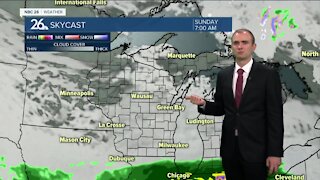
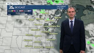
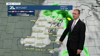
Parts of the Badger state experienced fall weather while other locations had an early taste of fall! A cold front is slowing moving through the state and there is some chilly air on the back side of this front causing a changeover from rainfall to snowfall. The closest the rain snow line got to our area this afternoon was Antigo. Some locations in Western Wisconsin measured a half inch of snow and that threat of snow will come to Northeast Wisconsin later tonight as this cold front continues to slide through. There remains a question on how much of the rainfall will transition to snowfall tonight but it does look like you have a better shot of seeing snow if you live north and west of the Fox Cities. While there is the slightest risk of a light dusting of snow on grassy and elevated surfaces, most locations will not see any accumulation. Temperatures will be chilly when you wake up Monday morning. Overnight low temperatures are going to drop from the upper 20s to the north to the lower ot mid 30s to the south. Afternoon highs will onl reach into the lower 40s with a breezy west and southwest wind between 10 to 20 mph with higher gusts. The Packers game will be a chilly one, dropping into the upper 30s by kick-off and only continuing to fall throughout the game into the mid 30s by the end of hte 4th quarter. A jacket and perhaps a few hand warmers would be a good idea to bring with you. The grasp of cold air lightens up on Tuesday with highs in the upper 40s and lower 50s.
-
 3:36
3:36
WGBA
7 months agoWill it be necessary to have both the AC & the heat on during the same day??
961 -
 3:37
3:37
WGBA
2 years agoGino Recchia NBC26 Weather Forecast
4 -
 3:17
3:17
WGBA
2 years agoGino Recchia NBC26 Weather Forecast
6 -
 3:01
3:01
WGBA
2 years agoGino Recchia NBC26 Weather Forecast
11 -
 3:28
3:28
WGBA
2 years agoGino Recchia NBC26 Weather Forecast
11 -
 3:02
3:02
WGBA
2 years agoGino Recchia NBC26 Weather Forecast
9 -
 3:10
3:10
WGBA
2 years agoGino Recchia NBC26 Weather Forecast
3 -
 3:51
3:51
WGBA
2 years agoGino Recchia NBC26 Weather Forecast
17 -
 3:52
3:52
WGBA
3 years agoGino Recchia NBC26 Weather Forecast
9 -
 3:34
3:34
WGBA
3 years agoGino Recchia NBC26 Weather Forecast
11