Export DWG 3D to Google Earth in "Topography in AutoCAD or BricsCAD" software
1 year ago
51
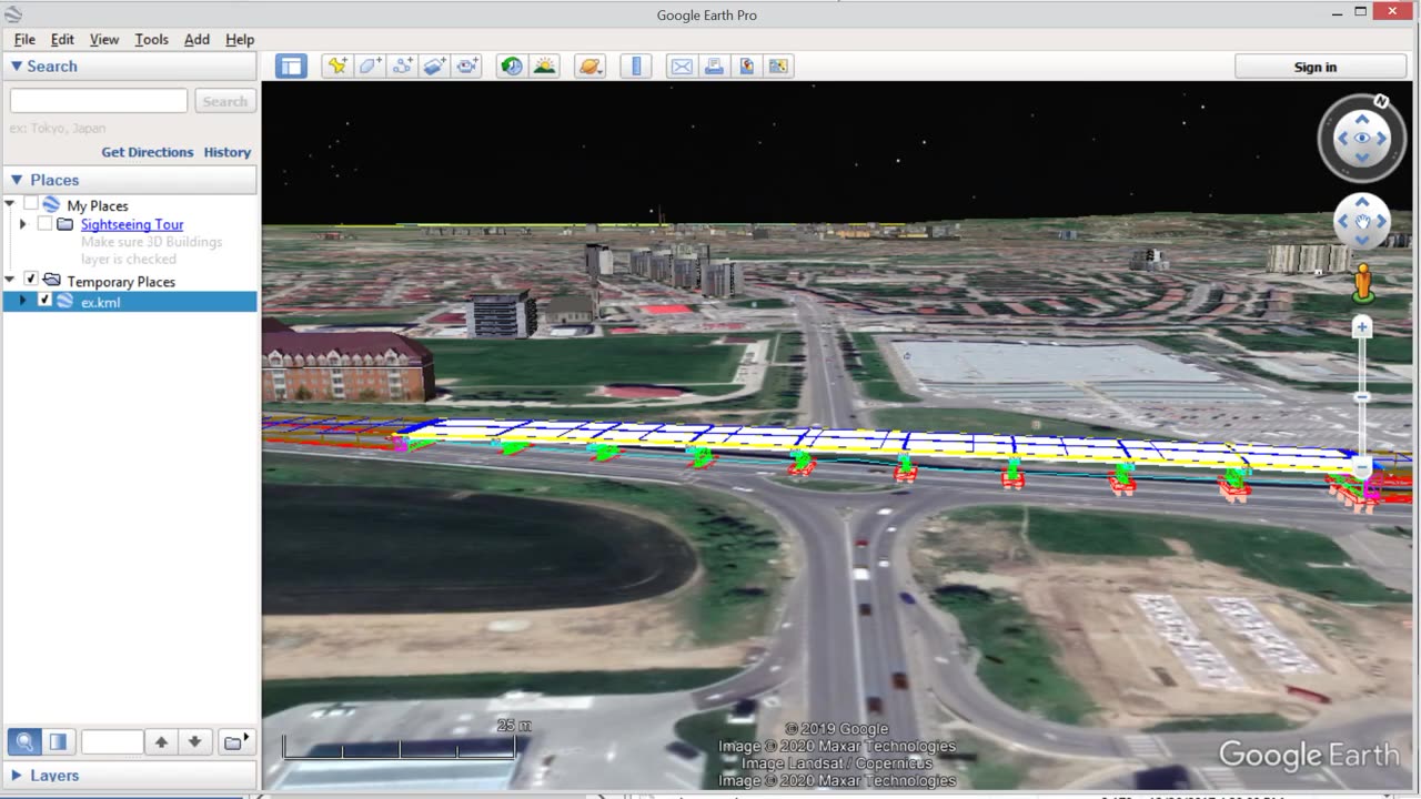
"Topography in AutoCAD or BricsCAD" software can draw a 3D DWG file in Google Earth, by generating a 3D KML file type. The program is an add on for AutoCAD or Bricscad.
In the example is a bridge designed with the BRIDGE program.
https://rcad.eu/triangulation-autocad/
https://rcad.eu/bridge/
Loading comments...
-
 LIVE
LIVE
SpartakusLIVE
4 hours agoLIVE from VACATION || #1 Greek God of a Streamer
406 watching -
 LIVE
LIVE
Alex Zedra
3 hours agoLIVE! New Devour Map
415 watching -
 2:20:45
Geeks + Gamers
4 hours agoGeeks+Gamers Play- FALL GUYS
19.5K -
 1:09:36
Glenn Greenwald
1 day agoTrump Escalates War Efforts Towards Venezuela; New Book Details Secret Horrors of Factory Farms | SYSTEM UPDATE #531
142K69 -

VapinGamers
3 hours ago $0.03 earnedJump Space - Nothing But Space, Fighting, and Screaming - !rumbot !music
15.5K -
 1:28:28
Badlands Media
17 hours agoAltered State: Season 4, Episode 1
35.5K7 -

MissesMaam
3 hours agoVariety Games w/ Friends💚✨
10.9K3 -
 53:05
53:05
The Mel K Show
6 hours agoLive Q&A From Planet Chaos with Mel K 10-15-25
55.8K4 -
 LIVE
LIVE
Cewpins
3 hours agoWorld Wide !WEED Review 🔥smoke sesh🍃420💨!MJ !giveaway
23 watching -
 2:03:37
RiftTV
8 hours agoRight Wing Infighting ESCALATES as INSANE Groupchat LEAKS | The Rift | Guest: Braeden Sorbo
54.5K9