MIchael Fish's NBC26 weather forecast
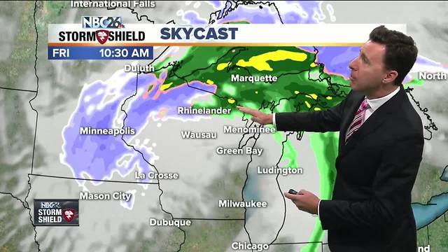
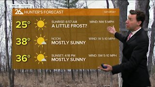
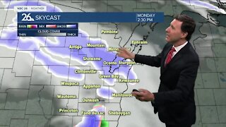
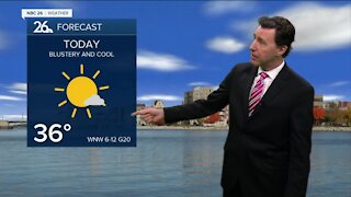
A low pressure system is tracking right through Wisconsin, today. Rain will be lifting to the north, then giving way to mostly cloudy skies with possibly a few lingering showers in the afternoon. Highs will top out in the mid-40s. Some areas, mainly to the far north and northwest could even see a few flakes later in the day. It looks like any snow accumulation should stay in far Northern and Northwest Wisconsin. We'll have a chance of a few hit-or-miss rain or snow showers as tonight goes on. Lows will bottom out in the low- to mid-30s. We could start Saturday with a stray rain or snow shower, but the day basically dries out as it goes on. It will be on the cool and blustery side again with highs in the mid-40s. Saturday night, we'll start to see a few breaks in the clouds which will allow our temperatures to dip below freezing in most locations. Lows will bottom out in the upper-20s. As of right now, Sunday looks dry and cool with highs in the mid-40s. Temps will stay below normal into next week with on & off chances for a few rain or snow showers.
-
 1:45
1:45
WGBA
2 years agoStudents excited to start at "huge and beautiful" Vel Phillips Middle School
434 -
 2:28
2:28
WGBA
5 years agoMichael Fish's NBC 26 weather forecast
7 -
 2:08
2:08
WGBA
5 years agoMichael Fish's NBC 26 weather forecast
9 -
 2:42
2:42
WGBA
5 years agoMichael Fish's NBC 26 weather forecast
3 -
 2:40
2:40
WGBA
5 years agoMichael Fish's NBC 26 weather forecast
5 -
 2:33
2:33
WGBA
5 years agoMichael Fish's NBC 26 weather forecast
4 -
 2:42
2:42
WGBA
5 years agoMichael Fish's NBC 26 weather forecast
5 -
 2:13
2:13
WGBA
5 years agoMichael Fish's NBC 26 weather forecast
4 -
 2:43
2:43
WGBA
5 years agoMichael Fish's NBC 26 weather forecast
4 -
 2:11
2:11
WGBA
5 years agoMichael Fish's NBC 26 weather forecast
8