The Illusion | Do Your Own Research Frens
The Illusion
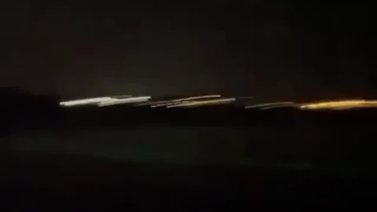
That's a N300WQ doing Bathymetric LIDAR scans. It's an Advanced LIDAR system operated by Woolpert, an engineering consulting firm, in support of the National Costal Mapping Program of the U.S. Army Corps if Engineers (USACE) to map coastal waters in high resolution.
The specific instrument on board is the TELEDYNE OPTEC CZMIL Bathymetric System.
This Sophisticated Sensor can reliably capture data down to depths of about 165 feet and can detect objects like sunken vessels or other navigation hazards etc. These scans are done every 5 years since 2004 and is useful for several things, supporting projects in different areas such as Defense. Marine Biology, Navigation, Meteorology, Oceanography, etc
If you are on the California Coast don't worry about exposure, time and height. Beyond leisure speed won't give you any problems it's just a Coast Scan System.
-
 1:13:28
Glenn Greenwald
2 hours agoGlenn Takes Your Questions on the Minneapolis School Shooting, MTG & Thomas Massie VS AIPAC, and More | SYSTEM UPDATE #506
25.9K12 -
 LIVE
LIVE
Barry Cunningham
1 hour agoBREAKING NEWS: PRESIDENT TRUMP THIS INSANITY MUST END NOW!
5,850 watching -
 LIVE
LIVE
Armadillofather
1 hour agoEspionage Action in the Den! | Metal Gear Solid Delta | You being here means so much!
74 watching -
 LIVE
LIVE
ABD
1 hour agoCyberpunk 2077 | EP 2 - The Opening Act Pt.2 | 4K UHD
29 watching -
 11:11
11:11
Michael Button
9 hours agoMy Joe Rogan Experience: Behind the Scenes
1711 -
 LIVE
LIVE
Charlotte Winslow
5 hours agoplaying GTA 5 for the First Time Ever in 2025 | OPEN WORLD WEDNESDAY
35 watching -
 LIVE
LIVE
Dragoon_B
2 hours agoDragoon - Counter Strike - Noob to Pro Grind
49 watching -
 8:26
8:26
WhaddoYouMeme
6 hours ago $0.02 earnedThe Internet Lied. He Just Destroyed His Life
1805 -
 DVR
DVR
The Mel K Show
2 hours agoLive Q&A with Mel K 8-27-25
8.21K3 -
 LIVE
LIVE
daniellesmithab
2 hours agoAlberta Next: Lloydminster Town Hall
37 watching