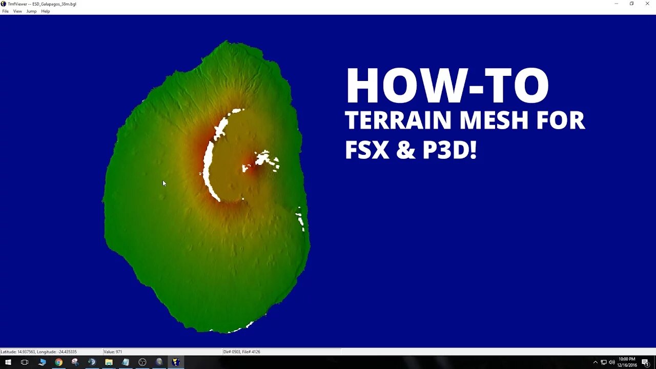
How to make Terrain Mesh from DEMs - FSX/P3D Scenery Tutorial
In this tutorial, we learn how to create Terrain Mesh for FSX and P3D using Digital Elevation Models (DEMs) downloaded from USGS.
Note: I am aware there are other scenery tutorials kicking around, but this tutorial was designed for a specific community in mind and posted here for ease of access.
USGS TNM
https://viewer.nationalmap.gov/basic/
USGS Earth Explorer
https://earthexplorer.usgs.gov/
Global Mapper
https://www.bluemarblegeo.com/products/global-mapper.php
QGIS (Alternative to Global Mapper)
https://www.qgis.org/en/site/about/index.html
FSX SDK Document: (As shown)
https://msdn.microsoft.com/en-us/library/cc707102.aspx#TheResampleTool
Need more development help? Start here!
https://fsdeveloper.com/
Scenery tutorial by:
https://emeraldscenerydesign.com/
Join me on Twitch!
https://www.twitch.tv/rotornut44
Tags
#tutorial #fsx #p3d
Recorded with OBS Studio. Edited in Adobe Premiere CC.
© 2016 Rotornut44. All rights reserved.
-
Phyxicx
4 hours agoRumble Spartans Halo Night! - HMR#20 - 11/14/2025
13.3K -
 10:15:18
FusedAegisTV
1 day ago*NEW F2P MMORPG, SoulsLike/Action Game // Global LAUNCH - EN Servers 🔴 FUSEDAEGIS
31.1K1 -
 3:31:00
Barry Cunningham
9 hours agoFOOD STAMPS FRAUD | STARBUCKS BARISTAS BIG MAD | MORE NEWS (AND NO REAL ESTATE!)
86.8K37 -
 LIVE
LIVE
Reidboyy
1 day ago $0.71 earned24/7 BO7 Camo Grind! Stream Doesn't End Until I Unlock EVERY Camo in Black Ops 7!
55 watching -
 2:27:02
TheSaltyCracker
6 hours agoTucker Blows Up FBI ReeEEStream 11-14-25
91.6K188 -
 3:46:36
I_Came_With_Fire_Podcast
15 hours agoThe Private Equity Crisis | Oh SNAP, Massive Fraud | Reindustrialization
14.5K9 -
 1:36:12
Glenn Greenwald
13 hours agoQ&A With Glenn: On the Epstein Emails; Chomsky's Friendship with Epstein; Differences Between Tucker Carlson and Nick Fuentes; the Babylon Bee's Attack on Megyn Kelly; and More | SYSTEM UPDATE #547
102K63 -
 1:03:12
Flyover Conservatives
1 day ago“The Time Will Never Be Just Right”: The ONE Mindset Shift Clay Clark Says Changes Everything | FOC Show
20.2K -
 58:39
58:39
Patriots With Grit
6 hours agoHow To Escape The Media Mind-Control Machine | Sam Anthony
13K1 -
 3:38:35
SynthTrax & DJ Cheezus Livestreams
17 hours agoFriday Night Synthwave 80s 90s Electronica and more DJ MIX Livestream EAGLE VISION / Variety Edition
21.4K