NBC26 Storm Shield Weather Forecast
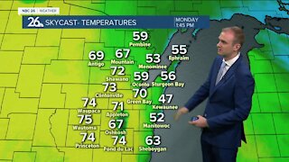
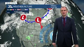
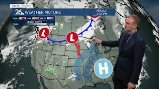
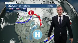
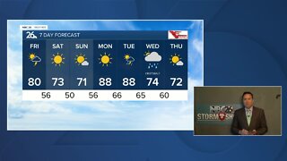
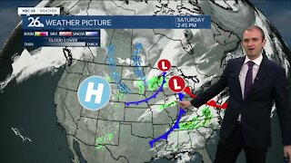
Strong to severe thunderstorms are likely tonight! All types of severe weather are possible......but the main threat will be straight-line damaging winds. Localized heavy downpours will also be a threat through the night as well. Another 1-3" of rain is likely with locally heavier amounts possible!! With many areas picking up 1-3" of rain last night any additional rainfall could result in flash flooding. Most of Tuesday during the daytime should probably have another one of those lulls in the precipitation as we wait for a strong cold front to arrive. Highs will top out in the low- to mid-80s. That cold front passes through the area tonight with more areas of showers and T'storms, mainly before midnight. Once again, with the very unstable atmosphere, some of these could bring severe weather. Cooler & less humid weather returns by Wednesday with a morning shower or sprinkle possible and highs only in the upper-60s. There will be a chance of a shower or T'storm of Friday night into Saturday, but as of now, your Labor Day weekend really doesn't look too bad with highs in the upper-70s to around 80.
-
 1:45
1:45
WGBA
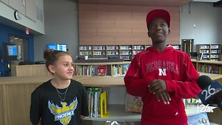
7 months agoStudents excited to start at "huge and beautiful" Vel Phillips Middle School
53 -
 4:02
4:02
WGBA
3 years agoGino Recchia NBC26 Weather Forecast
8 -
 3:46
3:46
WGBA
3 years agoGino Recchia NBC26 Weather Forecast
15 -
 2:44
2:44
WGBA
3 years agoGino Recchia NBC26 Weather Forecast
5 -
 3:12
3:12
WGBA
3 years agoGino Recchia NBC26 Weather Forecast
2 -
 3:24
3:24
WGBA
3 years agoNBC26 Storm Shield Forecast
6 -
 3:24
3:24
WGBA
3 years agoNBC26 Storm Shield Forecast
8 -
 4:48
4:48
WGBA
3 years agoGino Recchia NBC26 Weather Forecast
4 -
 2:08
2:08
WGBA
3 years agoGino Recchia NBC26 Weather Forecast
9 -
 1:29
1:29
WGBA
3 years agoNBC26 Storm Shield Forecast
7