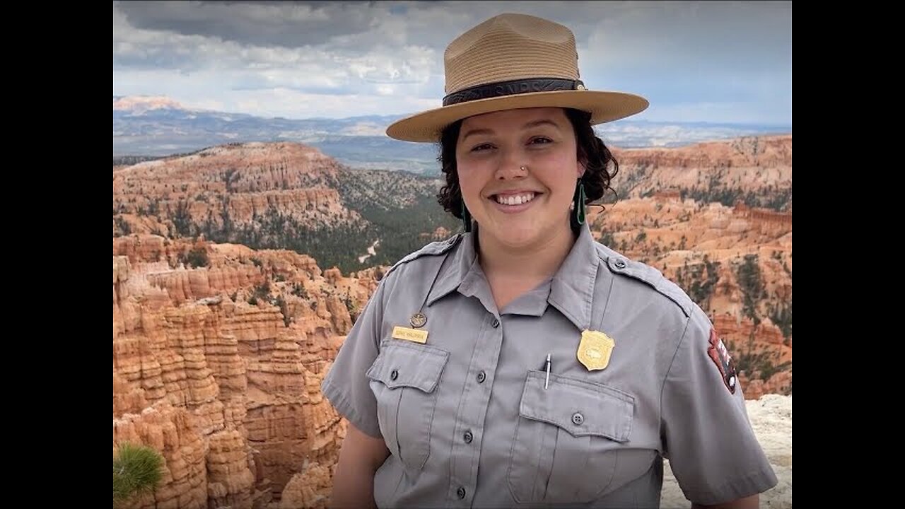
Seeing Satellite Benefits on the Ground with the National Park Service
1 year ago
7
From the hoodoos in Bryce Canyon to the caves of Carlsbad Caverns and the giant sequoias of Yosemite, did you know researchers use NASA satellite data in National Parks?
Our view from space can help monitor water resources, assess air quality, analyze fire patterns, track vegetation changes, and more. It all helps the National Park Service make informed decisions for protecting and restoring America’s most beautiful natural spaces.
Loading comments...
-
 DVR
DVR
RiftTV
3 hours agoCON INC: We Should All Just FORGET About Epstein | The Rift | Dinesh D’Souza, Lauren Witzke + More
14.8K2 -
 LIVE
LIVE
AlaskanBallistics
6 hours agobest .22lr Suppressor
65 watching -
 LIVE
LIVE
RalliedLIVE
6 hours ago $1.00 earned10 WINS WITH THE SHOTTY BOYS
105 watching -
 LIVE
LIVE
LIVE WITH CHRIS'WORLD
2 hours agoLIVE WITH CHRIS’WORLD - I Have So Many Questions Right Now
82 watching -
 LIVE
LIVE
SpartakusLIVE
2 hours agoWZ Solos || GCX St. Jude Charity Marathon @ 8PM EST
24 watching -
 LIVE
LIVE
FrizzleMcDizzle
2 hours agoTIKTOK BANNED ME LOL - Clair Obscure: Expedition 33
23 watching -
 58:21
58:21
BonginoReport
4 hours agoTrump Deepens MAGA’s Epstein Divide - Nightly Scroll w/ Hayley Caronia (Ep.91) - 07/16/2025
126K87 -
 LIVE
LIVE
GoodLifeGaming
4 hours ago🔴LIVE - DAY 2 - NEW PLAYER TRIES DESTINY 2 - PVP AND POWER GRINDING ALL DAY - ADVICE WELCOME!
10 watching -

The Rabble Wrangler
18 hours agoRimworld with The Best in the West!
20 -
 1:10:01
Playback Request Live
2 hours agoLevel Up: Our First Live Performance ft. Lady Desiree
9.07K2