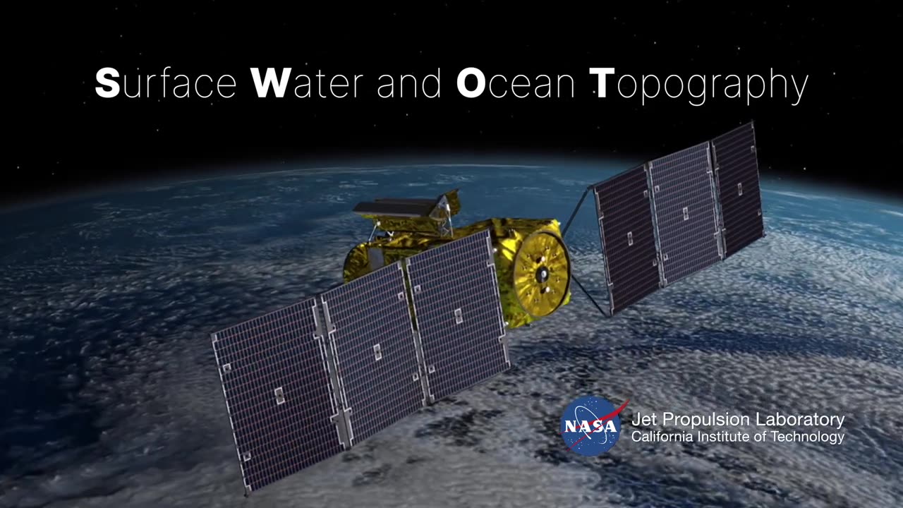
Mapping Earth's Future: Leveraging Satellite Technology with a SWOT Analysis
"Mapping Earth's Future: Leveraging Satellite Technology with a SWOT Analysis" is a comprehensive assessment that combines cutting-edge satellite technology with a strategic SWOT (Strengths, Weaknesses, Opportunities, Threats) analysis to empower communities and decision-makers in planning for a more sustainable and prosperous future.
In this unique endeavor, we harness the power of Earth science satellites to obtain a holistic view of our planet's dynamic systems. By examining its strengths, weaknesses, opportunities, and threats, we aim to unlock valuable insights and solutions for a wide range of challenges, from environmental sustainability to disaster preparedness.
Key Components of "Mapping Earth's Future":
Satellite Technology: This initiative capitalizes on the advanced capabilities of Earth-observing satellites. These orbiting platforms provide high-resolution imagery, real-time data, and multi-spectral analysis, enabling us to monitor natural resources, track climate patterns, and respond to emergencies swiftly.
Strengths Analysis: By identifying Earth's strengths, such as its natural resources, biodiversity, and geological stability, we can pinpoint opportunities for sustainable development, resource management, and conservation efforts.
Weaknesses Assessment: Understanding Earth's weaknesses, such as vulnerability to natural disasters, environmental degradation, and resource depletion, is crucial for implementing mitigation strategies and building resilience.
Opportunities Exploration: Examining opportunities within Earth's systems, like renewable energy sources, untapped resources, and emerging technologies, guides us in harnessing its potential for sustainable growth and innovation.
Threats Evaluation: Analyzing threats, including climate change, pollution, and ecosystem disruption, allows us to develop proactive measures to safeguard our planet and its inhabitants.
Community Engagement: This initiative promotes collaboration among governments, scientists, local communities, and organizations to collectively address Earth's challenges. Community input and participation are essential in creating inclusive and effective strategies.
Policy Recommendations: "Mapping Earth's Future" provides evidence-based policy recommendations and action plans tailored to local, regional, and global needs. These recommendations are designed to drive positive change and ensure a better future for all.
Data-driven Decision-Making: The project emphasizes the use of real-time satellite data and analytical tools to make informed decisions, respond to emergencies, and track progress over time.
By leveraging satellite technology and conducting a SWOT analysis on Earth's systems, "Mapping Earth's Future" offers a comprehensive and actionable roadmap for communities and decision-makers worldwide. This endeavor is a vital step toward a more sustainable, resilient, and prosperous future for our planet and its inhabitants.
-
 17:59
17:59
JohnXSantos
1 day ago $5.35 earnedI Gave AI 14 Days to Build NEW $5K/MONTH Clothing Brand
23.9K3 -
 2:44:07
DLDAfterDark
10 hours ago $16.03 earnedGun Talk - Whiskey & Windage - The "Long Range" Jouney - After Hours Armory
26.2K1 -
 9:37
9:37
Film Threat
12 hours agoSHELBY OAKS REVIEW | Film Threat
16.7K6 -
 35:40
35:40
The Mel K Show
7 hours agoMel K & Dr. Mary Talley Bowden MD | Heroes of the Plandemic: Doing What is Right No Matter the Cost | 10-25-25
44.3K13 -
 3:06:20
FreshandFit
12 hours agoNetworking At Complex Con With DJ Akademiks
211K23 -
 7:02:27
SpartakusLIVE
10 hours agoThe King of Content and the Queen of Banter || Duos w/ Sophie
42.3K2 -
 1:47:12
Akademiks
9 hours agoLive on complexcon
41.7K5 -
 3:07:36
Barry Cunningham
11 hours agoCAN PRESIDENT TRUMP STOP THE STORMS? ON AIR FORCE ONE | SNAP BENEFITS | MAMDANI | SHUTDOWN DAY 25
43.6K71 -
 13:38
13:38
Exploring With Nug
17 hours ago $9.21 earnedWe Searched the Canals of New Orleans… and Found This!
33.4K6 -
 13:36
13:36
Clintonjaws
1 day ago $35.15 earnedCBC 2024 Election Night - Highlights - This Is Priceless!
68.5K21