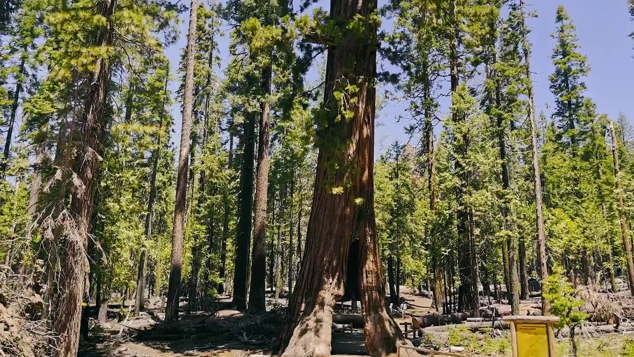
Seeing Satellite Benefits on the Ground with the National Park Service
Description
Seeing Satellite Benefits on the Ground with the National Park Service
NASA Video
127
Likes
20,057
Views
Sep 22
2023
From the hoodoos in Bryce Canyon to the caves of Carlsbad Caverns and the giant sequoias of Yosemite, did you know researchers use NASA satellite data in National Parks?
Our view from space can help monitor water resources, assess air quality, analyze fire patterns, track vegetation changes, and more. It all helps the National Park Service make informed decisions for protecting and restoring America’s most beautiful natural spaces.
This video can be freely shared and downloaded. While the video in its entirety can be shared without permission, the music and some individual imagery may have been obtained through permission and may not be excised or remixed in other products.
For more information on NASA’s media guidelines, visit https://nasa.gov/multimedia/guidelines.
-
 LIVE
LIVE
LFA TV
15 hours agoLFA TV ALL DAY STREAM - FRIDAY 8/1/25
4,881 watching -
 1:47:49
Dear America
3 hours agoHILLARY EXPOSED!! New Files Reveal She Was Behind It ALL!!! + Kamala Breaks Silence!!
100K75 -
 LIVE
LIVE
The Big Mig™
4 hours agoHillary Clinton & George Soros To GITMO NOW!!!
8,646 watching -
 LIVE
LIVE
Badlands Media
7 hours agoBadlands Daily: Aug 1, 2025
4,379 watching -
 2:11:10
Matt Kohrs
11 hours agoTrump Tanks Stocks, Breaking Market News & Payday Friday || Live Trading
13.8K1 -
 13:42
13:42
China Uncensored
13 hours agoChina's Invasion Has Begun
22K19 -
 LIVE
LIVE
Wendy Bell Radio
6 hours agoBUSTED
7,860 watching -
 4:02:39
The Bubba Army
1 day agoHulk Hogan had Leukemia? - Bubba the Love Sponge® Show | 8/01/25
97.1K5 -
 18:36
18:36
DeVory Darkins
11 hours ago $6.83 earnedTrump scores MAJOR WIN with Americas youth as Biden drops HORRIBLE speech
37.4K43 -
 14:13
14:13
Clickbait Wasteland
16 hours ago $5.70 earnedAsking New Yorkers Who they Support for Mayor: Harlem
54.2K37