Seeing Satellite Benefits on the Ground with the National Park Service
2 years ago
6
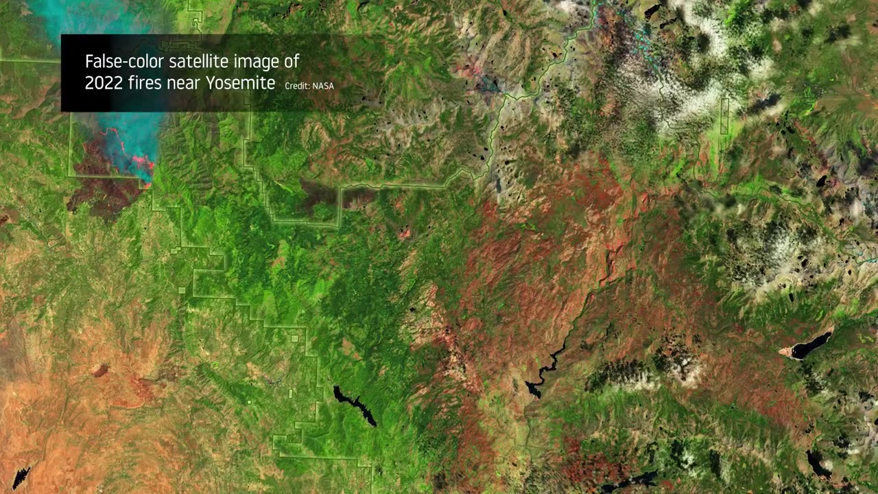
From the hoodoos in Bryce Canyon to the caves of Carlsbad Caverns and the giant sequoias of Yosemite, did you know researchers use NASA satellite data in National Parks?
Our view from space can help monitor water resources, assess air quality, analyze fire patterns, track vegetation changes, and more. It all helps the National Park Service make informed decisions for protecting and restoring America’s most beautiful natural spaces.
This video can be freely shared and downloaded. While the video in its entirety can be shared without permission, the music and some individual imagery may have been obtained through permission and may not be excised or remixed in other products.
For more information on NASAvedioknowledge
Loading comments...
-
 3:04:24
Barry Cunningham
5 hours agoPRESIDENT TRUMP HAS LAUNCHED HIS OPERATION TO TAKE DOWN THE DEEP STATE! ARE YOU READY?
35.7K65 -
 23:53
23:53
MYLUNCHBREAK CHANNEL PAGE
20 hours agoIstanbul SHOULD NOT Exist - Pt 3
10.6K9 -
 LIVE
LIVE
GritsGG
4 hours agoQuad Win Streaks!🫡 Most Wins in WORLD! 3600+
333 watching -
 1:18:05
Jeff Ahern
4 hours ago $2.64 earnedThe Saturday Show with Jeff Ahern
19.2K2 -
 LIVE
LIVE
GamerGril
4 hours agoI Know What You Did Last Stream 💞Dying Light: The Beast💞
153 watching -
 1:24:47
iCkEdMeL
4 hours ago $8.13 earnedFrom Music to Murder? D4VD’s Tesla Horror Story
30.6K12 -
 LIVE
LIVE
This is the Ray Gaming
2 hours agoNEW LOOK WHO DIS? | Rumble Premium Creator
66 watching -
 LIVE
LIVE
TinyPandaface
1 hour agoYour FACE is a Gaming Channel! | Escape Memoirs: Mini Stories - #2
38 watching -
 2:37:14
ChrisBoken
3 hours agoDayZ - Our Server Goes Live
17 -
 LIVE
LIVE
Spartan
3 hours agoFirst time playing Black Myth Wukong
60 watching