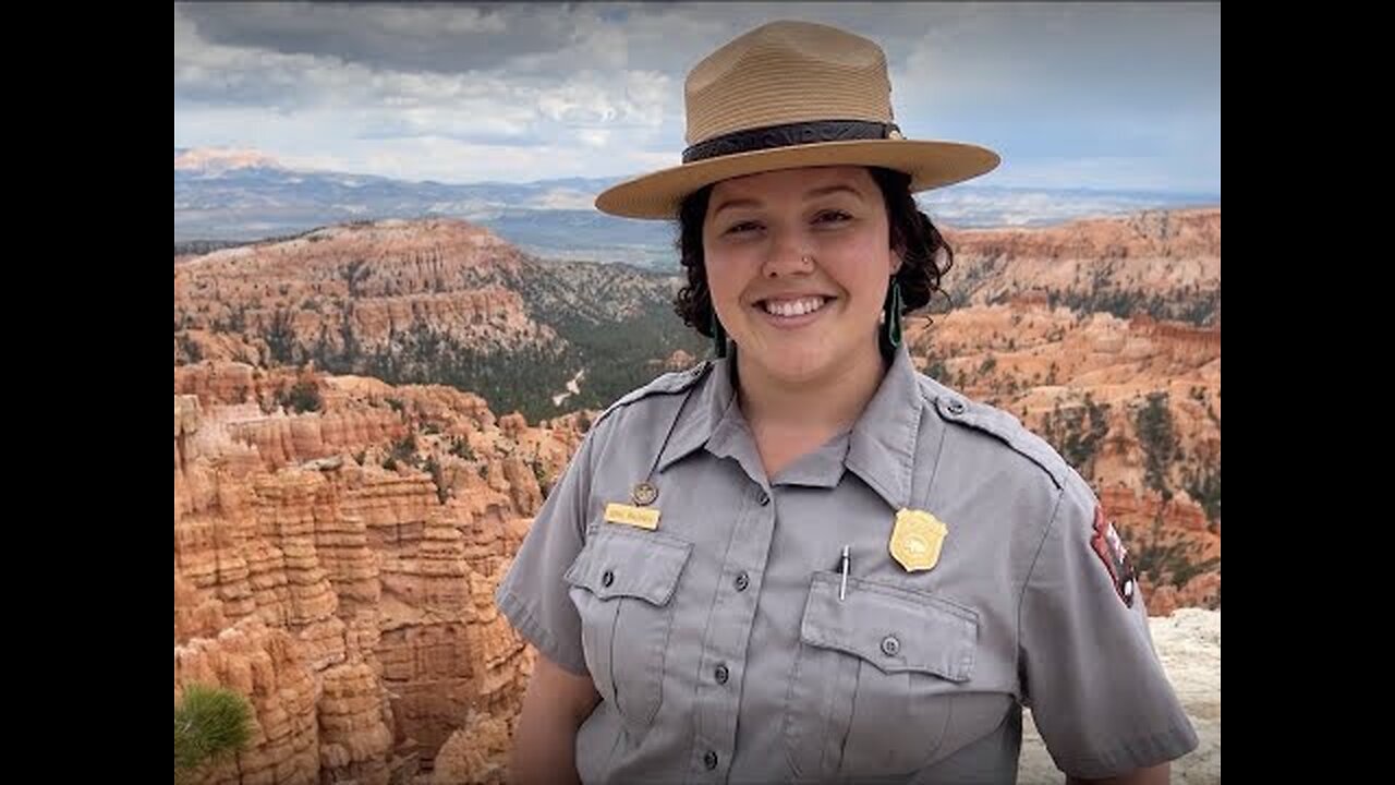
Seeing Satellite Benefits on the Ground with the National Park Service
From the hoodoos in Bryce Canyon to the caves of Carlsbad Caverns and the giant sequoias of Yosemite, did you know researchers use NASA satellite data in National Parks?
Our view from space can help monitor water resources, assess air quality, analyze fire patterns, track vegetation changes, and more. It all helps the National Park Service make informed decisions for protecting and restoring America’s most beautiful natural spaces.
This video can be freely shared and downloaded. While the video in its entirety can be shared without permission, the music and some individual imagery may have been obtained through permission and may not be excised or remixed in other products.
For more information on NASA’s media guidelines, visit https://nasa.gov/multimedia/guidelines.
-
 2:17:10
Matt Kohrs
10 hours agoMarket Open: New Highs, Tesla Stock Skyrockets & The Week Ahead || Live Trading
35K3 -
 56:46
56:46
VSiNLive
1 hour ago $0.27 earnedA Numbers Game with Gill Alexander | Hour 1
10K -
 32:27
32:27
Rethinking the Dollar
1 hour agoGENIUS ACT: CBDC Is Coming Through the Backdoor | Morning Check-In
5.89K -
 1:10:13
Dear America
3 hours agoTrump EXPOSES Obama RUSSIA RUSSIA RUSSIA HOAX!! SEND THEM ALL TO JAIL!!!
110K104 -
 1:35:23
Badlands Media
9 hours agoBadlands Daily: July 21, 2025
46.7K3 -
 LIVE
LIVE
Wendy Bell Radio
7 hours agoTRAITORS.
10,157 watching -
 LIVE
LIVE
GritsGG
3 hours agoWin Streaking! Most Wins 3100+! 🔥
59 watching -
 12:21
12:21
Bearing
3 hours agoStephen Colbert: Another UNEMPLOYED Woke Loser 🤣🦀
15.2K26 -
 1:01:14
The Finance Hub
20 hours ago $1.09 earnedI CAN'T BELIEVE WHAT JUST GOT REVEALED ABOUT PAM BONDI!!!
9.02K14 -
 1:28:55
Chicks On The Right
6 hours agoObama’s Fingerprints on Russia Hoax, WNBA Whines (Again), & AI Gets Creepy | Chicks on the Right
34K8