Seeing Satellite Benefits on the Ground with the National Park Service_1080p
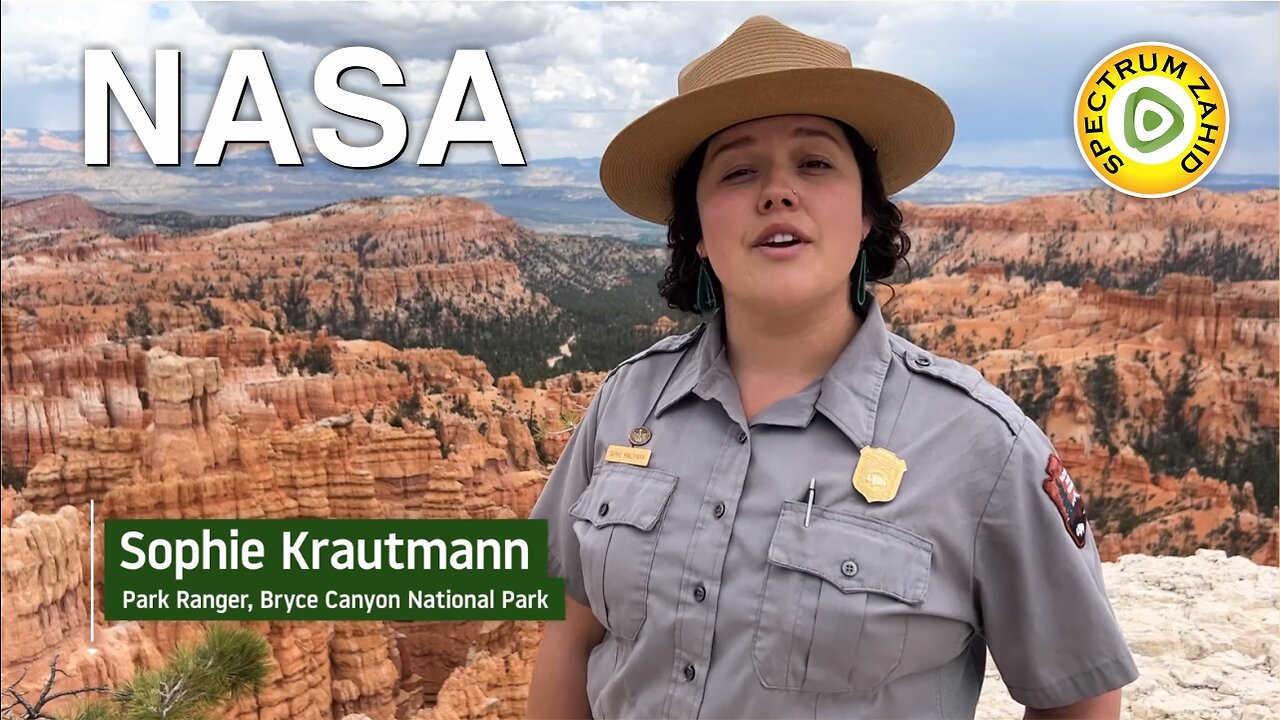
From the hoodoos in Bryce Canyon to the caves of Carlsbad Caverns and the giant sequoias of Yosemite, did you know researchers use NASA satellite data in National Parks?
Our view from space can help monitor water resources, assess air quality, analyze fire patterns, track vegetation changes, and more. It all helps the National Park Service make informed decisions for protecting and restoring America’s most beautiful natural spaces.
This video can be freely shared and downloaded. While the video in its entirety can be shared without permission, the music and some individual imagery may have been obtained through permission and may not be excised or remixed in other products.
For more information on NASA’s media guidelines, visit https://nasa.gov/multimedia/guidelines.
Special Thanks for NASA
-
 1:37:28
Sarah Westall
3 hours agoReal Intel: Power Struggles Fueled by Blackmail, Surveillance & Coercion w/ Dr. Dave Janda
18.2K13 -
 9:49
9:49
MattMorseTV
5 hours ago $9.89 earnedNewsom's CAREER just WENT UP IN FLAMES.
21.6K61 -
 LIVE
LIVE
Spartan
3 hours agoHalo for a bit, Octopath after maybe
134 watching -
 3:49:55
sophiesnazz
4 hours ago $2.04 earned6kd in these lobbies !socials !specs
23.7K1 -
 1:42:00
Vedic compatability astrology
2 hours agoAbijit Shuckla: The Epic 8, 17, 25 Adventure!
5.21K1 -
 1:17:18
Jeff Ahern
5 hours ago $13.30 earnedThe Sunday Show with Jeff Ahern
41.1K6 -
 4:17:59
The Rabble Wrangler
5 hours agoSunday Shootouts in Battlefield 6 - Phantom Edition Giveaway!
14.1K -
 LIVE
LIVE
Meisters of Madness
3 hours agoWuchang - Part 6
45 watching -
 34:55
34:55
Stephen Gardner
5 hours ago🔥Trump Admin FINALLY shutting it ALL DOWN!
46.4K89 -
 LIVE
LIVE
CassaiyanGaming
5 hours agoBattlefield 6 Open Beta Weekend!
33 watching