NASA Joins Jane Goodall to Conserve Chimpanzee Habitats-4K-NASA OFFICAL
1
2
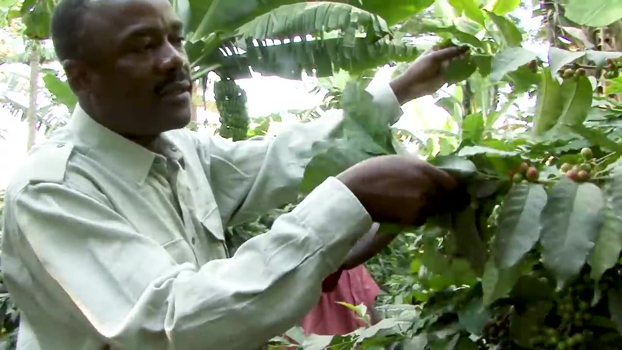
Earth-observing satellites like Landsat have documented the shrinking of chimpanzee habitat in Africa's equatorial forest belt. The Jane Goodall Institute (JGI) is using satellite data to empower local communities to drive conservation on their own land by creating habitat suitability maps for chimpanzees.
Mobile apps are also being used to bring in data in real-time so that communities can protect their village forest reserves and create land use plans for watersheds, people, and chimpanzees.
After years of forest loss, the last few decades have seen habitats recovering.
Here is an elaboration of the article:
How JGI is using satellite data to empower local communities
JGI is working with NASA and other partners to use satellite data to create habitat suitability maps for chimpanzees. These maps show areas that are most likely to be suitable for chimpanzee habitat, based on factors such as forest cover, elevation, and proximity to water and food sources.
JGI then shares these maps with local communities and helps them to develop conservation plans. These plans may include activities such as planting trees, restoring degraded forests, and reducing poaching.
Mobile apps are also being used to bring in data in real-time. For example, JGI has developed an app called Chimpanzee Tracker, which allows community members to report sightings of chimpanzees and other wildlife. This data is used to monitor chimpanzee populations and identify areas where conservation efforts are needed.
Conservation dashboards
JGI has also developed conservation dashboards, which provide real-time data on forest loss, chimpanzee sightings, and other factors. These dashboards are used by JGI staff and community members to track the progress of conservation efforts and make informed decisions about where to allocate resources.
Habitat recovery
After years of forest loss, the last few decades have seen habitats recovering in some areas. This is thanks to the hard work of conservation organizations like JGI and the local communities they work with.
The use of satellite data and mobile apps is helping to empower local communities to drive conservation on their own land. This is essential for protecting chimpanzees and their habitats in the long term.
-
 LIVE
LIVE
Jeff Ahern
1 hour agoThe Saturday Show with Jeff Ahern
347 watching -
 23:54
23:54
Tactical Advisor
1 hour agoAll Carbon Fiber Rifle | Vault Room Live Stream 032
3.32K2 -
 47:09
47:09
Vince Dao
3 hours ago $7.61 earnedFed Chair, Pam Bondi Consider RESIGNING as Trump Scores MAJOR Economic and Immigration Victories
20.5K23 -
 47:41
47:41
Michael Franzese
12 hours agoI Don’t Believe the Epstein Case Is Closed — Here’s Why
26K55 -
 36:50
36:50
The Brett Cooper Show
2 days ago $9.67 earnedWhy Conservatives Are Outraged At Trump & Superman Controversy | Episode 47
39.5K67 -
 16:43
16:43
Blackstone Griddles
1 day ago3 Classic Recipes for New Griddle Owners with CJ Frazier
20.1K2 -
 LIVE
LIVE
VladsGamingCartel
4 hours ago7 Days to Die | Vlad & Tippsy Stream #BadAtGaming
141 watching -
 35:38
35:38
Sam Sorbo
4 hours agoLIVE from TPUSA SAS: Fighting for Parents, Freedom, and the First Amendment
22.1K7 -
 16:09
16:09
Professor Nez
4 hours ago🚨BIDEN'S DOCTOR STONEWALLS: What Are They HIDING?
30.3K18 -
 3:08:37
I_Came_With_Fire_Podcast
13 hours agoThe U.S. is Reverse Engineering UAP Technology Faster Than China
27.4K13