Neelum Valley, Azad Kashmir, Sharda, Kel, Arang Kel, Taobat travel documentary
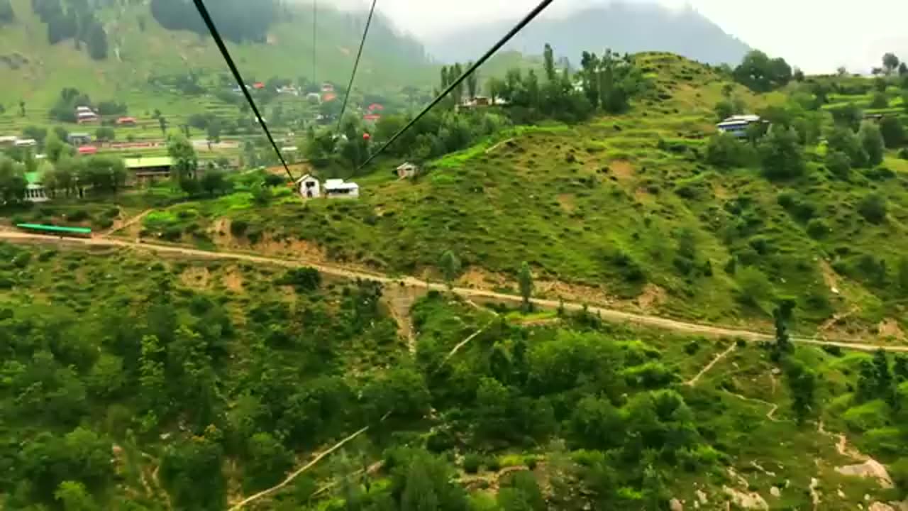
In this vlog we take you through some beautiful tourist places of Neelum Valley, Azad Kashmir. Our journey starts from Muzaffarabad and we travel through areas such as Athmuqam, Sharda, Kel, Arrang Kel and Taobat. We came across some spectacularly beautiful and scenic places while travelling through Neelum Valley. In this video you will see: tourist places in Neelum Valley, architectural design of houses in Neelum and some excerpts of Kashmiri people in Neelum Valley. You will also see magnificent Neelum River flowing between Azad Kashmir and the Indian Occupied Kashmir, serving as the Line of Control.
Neelum District (also spelt as Neelam; Urdu: ضلع نیلم), is the northernmost district of Azad Kashmir, Pakistan. Taking up the larger part of the Neelam Valley, the district has a population of 191,000 (as of 2017). It was badly affected by the 2005 Kashmir earthquake.
The Neelum River was known before Partition as Kishan Ganga and was subsequently renamed after the village of Neelam. It flows down from the Gurez Valley in Indian Occupied Jammu and Kashmir and roughly follows first a western and then a south-western course until it joins the Jhelum River at Muzaffarabad. The valley is a thickly wooded region with an elevation ranging between 4,000 feet (1,200 m) and 7,500 feet (2,300 m), the mountain peaks on either side reaching 17,000 feet (5,200 m).[5] Neelum Valley is 144 kilometres (89 mi) long.
Most of the valley is taken up by the Neelum District(Urdu: ضلع نیلم). The district is bordered on the south-west by Muzaffarabad District, which also encompasses the lower reaches of the valley; to the north-west beyond the mountains lies the Kaghan Valley in Khyber Pakhtunkhwa's Mansehra District; to the north and north-east are the Diamer, Astore and Skardu districts of Gilgit-Baltistan. To the south and east are the Kupwara and Bandipora districts of Indian Kashmir. The Line of Control runs through the valley – either across the mountains to the south-east, or in places right along the river, with several villages on the left bank falling on the Indian side of the border.
Tourist attractions include:
Arang Kel
Athmuqam
Chitta Katha Lake
Dhani Waterfall
Dowarian
Ratti Gali Lake
Halmat
Kel
Keran
Kutton
Sharda
Taobat
Jagran
-
 38:14
38:14
The Official Corbett Report Rumble Channel
23 hours agoWar Is A Crime
3.59K13 -
 LIVE
LIVE
BEK TV
22 hours agoTrent Loos in the Morning - 9/09/2025
424 watching -
 LIVE
LIVE
The Bubba Army
21 hours agoMore Epstein Files Dropped! - Bubba the Love Sponge® Show | 9/09/25
3,613 watching -
 LIVE
LIVE
FyrBorne
18 hours ago🔴Warzone M&K Sniping: How To Harness The Beast (Of Sniping)
130 watching -
 7:02
7:02
Sugar Spun Run
23 hours ago $1.17 earnedBrownies from Scratch
25.3K5 -
 10:07
10:07
The Official Steve Harvey
15 hours ago $0.35 earned82 Years of Love, Laughs & Keeping It Real
5.72K1 -
 7:00
7:00
DropItLikeItsScott
14 hours ago $0.95 earnedIs This The Best 1911 Pistol Ever Made? Oriskany Arms 1911
9.23K2 -
 2:03:01
MG Show
20 hours agoBiden Auto Pen Scandal; President Trump White House Religious Liberty Commission
17.7K15 -
 14:18
14:18
Actual Justice Warrior
3 days agoBody Camera Video DESTROYS BLM Hoax
15.7K14 -
 21:17
21:17
itsSeanDaniel
1 day agoCNN Host's Vaccine Lies BACKFIRE in Front of MAGA Doctor
14.6K15