Michael Fish's NBC26 weather forecast
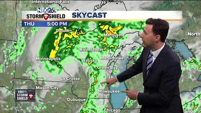
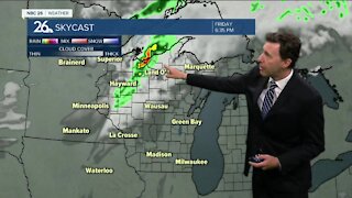
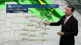
An unseasonably strong low pressure system is heading right for Wisconsin which will allow our weather to become much more active as the day wears on, today. Expect occasional showers and T'storms to become more numerous as the day progresses. Depending on where the warm front sets up, the farther you live to the south, the better your chance of an afternoon storm bringing you some gusty wind and hail. Highs will top out around 70, with areas to the south possibly becoming even warmer. Tonight, that low pressure and cool front will be passing through with occasional showers and T'storms. Once again, depending on where that warm front sets up, the farther you live to the south, the better your chance of a t'storm bringing you some gusty wind and hail. As the low pressure moves through, this activity will become less numerous as the night progresses. Overnight lows will top out in the mid-50s.
-
 1:57
1:57
WGBA
1 year agoHow the City of Green Bay is hoping a $1.6M investment will make the community safer for pedestrians
3661 -
 2:42
2:42
WGBA
4 years agoMichael Fish's NBC 26 weather forecast
3 -
 2:43
2:43
WGBA
4 years agoMichael Fish's NBC 26 weather forecast
2 -
 2:00
2:00
WGBA
4 years agoMichael Fish's NBC 26 weather forecast
5 -
 2:33
2:33
WGBA
4 years agoMichael Fish's NBC 26 weather forecast
6 -
 1:54
1:54
WGBA
4 years agoMichael Fish's NBC 26 weather forecast
2 -
 2:48
2:48
WGBA
4 years agoMichael Fish's NBC 26 weather forecast
6 -
 2:47
2:47
WGBA
4 years agoMichael Fish's NBC 26 weather forecast
18 -
 2:47
2:47
WGBA
4 years agoMichael Fish's NBC 26 weather forecast
8 -
 2:35
2:35
WGBA
4 years agoMichael Fish's NBC 26 weather forecast
2