X West Antarctic Glacier Ice Flows and Elevation Change
1 year ago
3
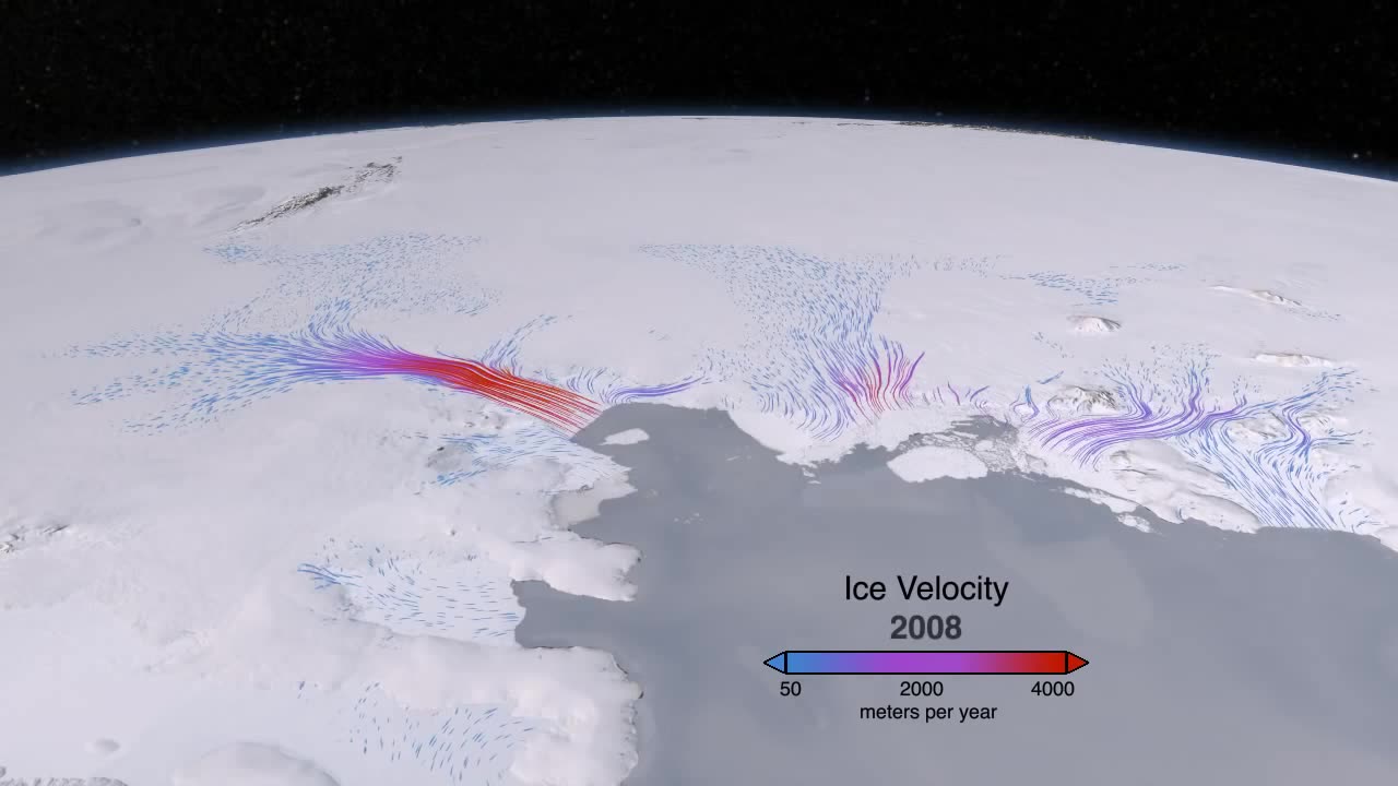
This animation shows glacier changes detected by ATM, ICESat and ice bridge data in the highly dynamic Amundsen Embayment of West Antarctica. Integrating these altimetry sources allows us to estimate surface height changes throughout the drainage regions of the most important glaciers in the region. We see large elevation changes at the coast on Thwaites glacier, at the center of the images, and large and accelerating elevation changes extending inland from the coast on Pine Island and Smith glaciers, to the left and right of the images, respectively.
Loading comments...
-
 10:53
10:53
Nikko Ortiz
2 days agoWORST Clips On The Internet
81.4K26 -
 3:42:38
FreshandFit
11 hours agoShannon Sharpe Fired By ESPN! W or L?
64.4K64 -
 2:18:29
Badlands Media
13 hours agoDevolution Power Hour Ep. 376: Optics, Explosions & the War for the Narrative
138K40 -
 37:46
37:46
Stephen Gardner
11 hours ago🔥Trump NEVER expected THIS WIN as Schumer has EPIC MELTDOWN!
39.2K37 -
 2:02:41
Inverted World Live
8 hours agoNASA Engineer Says Trillions of Shape-Shifting, Cloaked Devices are Hidden on Earth| Ep. 83
33.4K11 -
 3:12:37
TimcastIRL
8 hours agoGOP Councilman DOUSED IN GAS, Set ON FIRE In Virginia, Suspect In Custody | Timcast IRL
244K89 -
 2:32:23
The Quartering
7 hours agoOn To The Big Bosses! Act 2 Of Expedition 33
60.5K6 -
 7:36:34
SpartakusLIVE
9 hours agoTiger Blood RESTOCKED and 30% off w/ code SPARTAKUS30
85.5K -
 24:58
24:58
Law&Crime
10 hours ago $3.24 earnedSecond Note Leaves Disturbing Clues in New York City Killings
38.9K12 -
 1:36:57
Badlands Media
1 day agoAltered State S3 Ep. 39: Earthquakes, Energy Games & the Fall of the Narrative
76.1K16