NASA ARSET: Generating a Digital Elevation Model (DEM), Part 3/3
2 years ago
3
Advanced Webinar: SAR for Disasters and Hydrological Applications
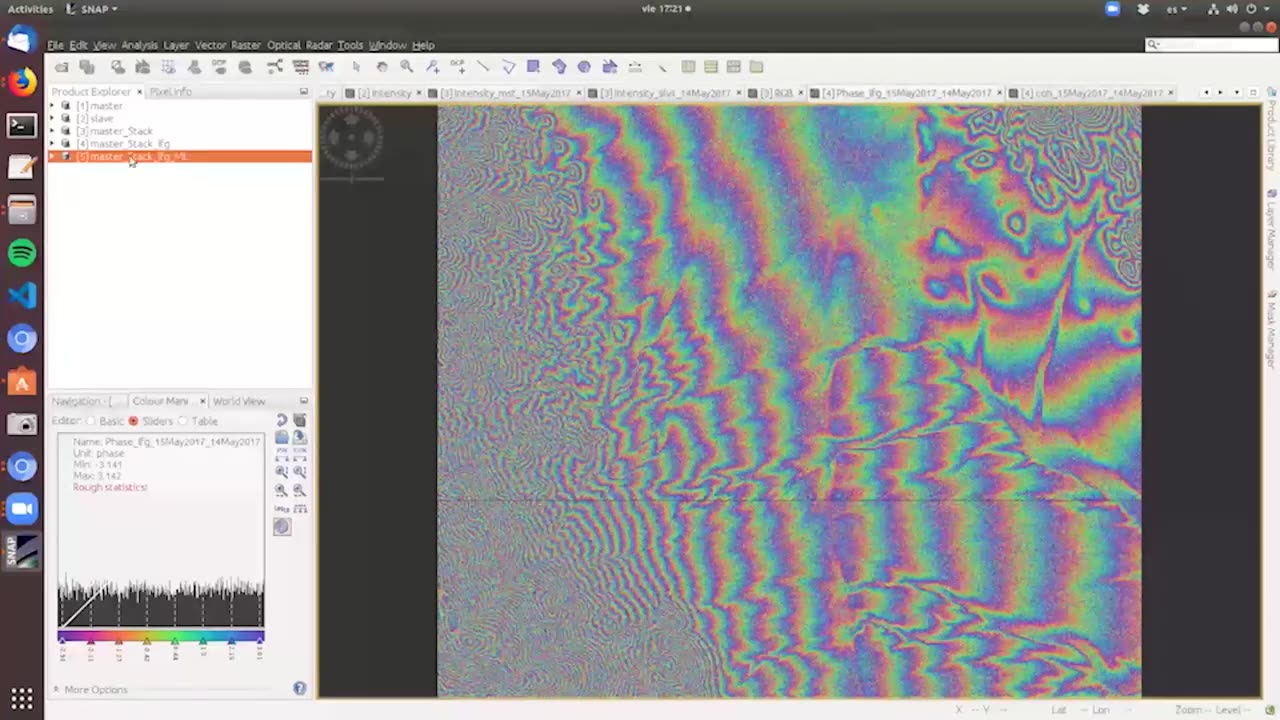
Part Three: Generating a Digital Elevation Model (DEM)
Featuring a guest speaker from Argentina’s CONAE, participants will learn how to generate a digital elevation model (DEM) through InSAR techniques. The first part of the session will cover the physics behind using two SAR phase images to generate a DEM. The remainder of the time will focus on how to generate a DEM.
Download materials from this presentation:
Loading comments...
-
 LIVE
LIVE
Dr Disrespect
2 hours ago🔴LIVE - DR DISRESPECT - BATTLEFIELD 6 - REDSEC DUOS - WIN WIN WIN
2,542 watching -
 LIVE
LIVE
Side Scrollers Podcast
2 hours agoAngry Joe’s TDS/Halo Meltdown + Console War is OVER + Twitch Staff FIRED + More | Side Scrollers
606 watching -
 LIVE
LIVE
The Shannon Joy Show
1 hour agoThe Persecution Of Reiner Fuellmich - The World’s Original COVID Whistleblower! With Human Rights Advocate Seba Terribilini
258 watching -
 LIVE
LIVE
The Mel K Show
2 hours agoMORNINGS WITH MEL K -Declass Tidal Wave: The Unstoppable March Towards Justice - 10-29-25
765 watching -
 1:01:54
Grant Stinchfield
1 hour agoGAVIN NEWSOM FOR PRESIDENT?! AMERICA’S NEXT DISASTER IN WAITING!
4.75K6 -
 LIVE
LIVE
LFA TV
15 hours agoLIVE & BREAKING NEWS! | WEDNESDAY 10/29/25
3,396 watching -
 15:52
15:52
Professor Nez
1 hour agoTHIS is REALLY BAD for Democrats! NEW Epstein Bombshell JUST DROPPED!
5.81K3 -
 2:23:57
LadyDesireeMusic
2 hours ago $1.81 earnedPiano & Convo Geek Culture Classics and More Rumble Rants Grant Live Requests
13.9K2 -
 LIVE
LIVE
Viss
3 hours ago🔴LIVE - Viss & Dr Disrespect Dominate Duos In Battlefield RedSec!
114 watching -
 1:01:44
VINCE
4 hours agoGov't Shutdown Is Blowing Up In Dems' Faces | Episode 157 - 10/29/25
160K100