Premium Only Content
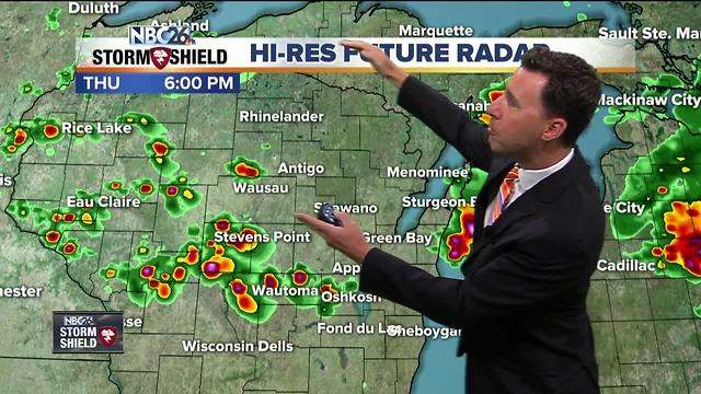
Michael Fish's NBC26 Weather Forecast
The forecast today consists of chances of T'storms, but there's a wildcard: A large complex of T'storms moving out of Minnesota may sweep through parts of the area. When you bring in showers or T'storms, it scours the atmosphere behind it, stabilizing things. We're going to have a lot of ingredients coming together for strong to severe storms: Heat, humidity, wind shear and a cold front as the trigger. The problem is, like any severe weather, this is not a guarantee. If the storm complex from the NW holds together, it will hinder the strength of any storm that would develop in the afternoon. If we see more sun, that would give any storm that would form a lot of extra energy this afternoon. Highs look to top out in the upper 80s if we see all of that sun. It will also be quite humid. Our best shot at widespread strong to severe T'storm activity would be this. If we form a bowed segment of storms, this could bring high wind and hail as the main threats......but all types of severe weather are possible. These will move through during the evening hours, then move out as the cold front sweeps through late tonight. Overnight lows will be in the mid 60s.
-
 1:45
1:45
WGBA
1 year agoStudents excited to start at "huge and beautiful" Vel Phillips Middle School
295 -
 2:00
2:00
WGBA
4 years agoMichael Fish's NBC 26 weather forecast
5 -
 2:33
2:33
WGBA
4 years agoMichael Fish's NBC 26 weather forecast
6 -
 2:48
2:48
WGBA
4 years agoMichael Fish's NBC 26 weather forecast
6 -
 2:47
2:47
WGBA
4 years agoMichael Fish's NBC 26 weather forecast
18 -
 2:47
2:47
WGBA
4 years agoMichael Fish's NBC 26 weather forecast
8 -
 2:35
2:35
WGBA
4 years agoMichael Fish's NBC 26 weather forecast
2 -
 2:34
2:34
WGBA
4 years agoMichael Fish's NBC 26 weather forecast
4 -
 2:58
2:58
WGBA
4 years agoMichael Fish's NBC 26 weather forecast
4 -
 2:25
2:25
WGBA
4 years agoMichael Fish's NBC 26 weather forecast
13