Grant Narrows Regional Park
Grant Narrows Regional Park To reach Grant Narrows park, drive east of the Pitt River Bridge on the Lougheed Highway (Highway 7). You are now in Pitt Meadows, about 25 km (15.5 mi.) from Vancouver. Turn north on Harris Road at the traffic lights where a large sign points to Pitt Lake. You begin to drive through agricultural land at this point, past prosperous-looking dairy and tree farms. Turn right on McNeil Road, then left on 132nd Avenue and left again at Neaves Road, following it north past the Swaneset Bay golf course, with its imposing clubhouse. Neaves crosses both the south and north arms of the Alouette River, along whose 17 km (10.5 km) of dike trails you might see people walking, jogging, cycling or horseback riding. Beyond the narrow bridge that spans the North Alouette, the road becomes rougher as its name changes from Neaves to Rannie. The park lies 10 km (6.2 mi.) north of here.
-
 5:59
5:59
irnieracing
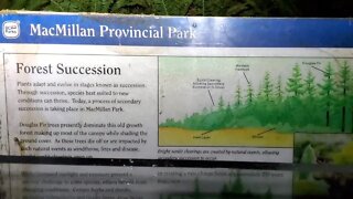
1 year agoCathedral Trail MacMillan Prov. Park - Old Growth Forest
11 -
 0:39
0:39
ExtraLife
4 years agoGolden Ears Regional Park
1483 -
 1:58:59
PureGosu
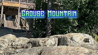
1 year agoGrinding Grouse Mountain!
9 -
 5:33
5:33
Hiking Trails In Ontario
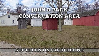
1 year agoJOHN R PARK Homestead Conservation Area
38 -
 8:57
8:57
Monica TV Toronto
1 year agoSaigeon Trail (Extension) | Boardwalks & Marshland | Richmond Hill, ON 🇨🇦 | Hiking | Relive | 4K
16 -
 0:42
0:42
HikingViking
2 years agoForging a Path – Central Oregon – Vista Butte Sno-Park – 4K
34 -
 1:00
1:00
jpcebuana
3 years agoCanada Goose at Ambleside Park
22 -
 4:50
4:50
KMGH
5 years agoGrant funds public bike paths through people’s backyards
27 -
 2:27
2:27
HikingViking
2 years agoThe Flat Meadow Connector Section of Deschutes River Trail – Central Oregon
7 -
 20:05
20:05
My Self Reliance
2 years agoPriorities, Spring in the Wilderness, Growing Food in the Forest, Raised Garden Beds
532