Premium Only Content

Earth Science Satellite Will Help Communities Plan for a Better Future
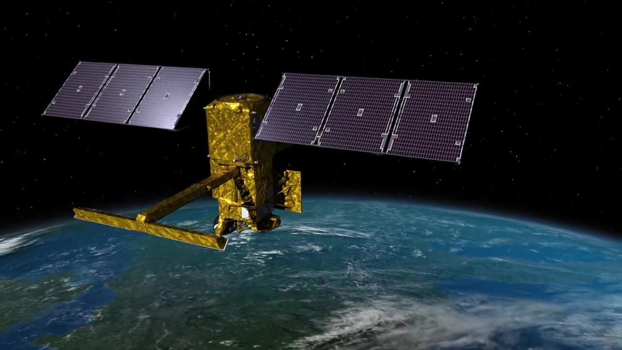
A new Earth science mission, jointly led by NASA and the French space agency Centre National deludes Spatulas (CNES), aims to empower communities in planning for a better future by surveying the Earth's salt and freshwater bodies. The Surface Water and Ocean Topography (SWOT) mission's primary objective is to measure water height in various water bodies, including lakes, rivers, reservoirs, and oceans.
As climate change continues to accelerate the water cycle, many communities worldwide face the dual challenges of increasing inundation and water scarcity. SWOT's invaluable data will be harnessed to enhance flood forecasts and monitor drought conditions. This data will be crucial for a wide range of stakeholders, including water management agencies, civil engineers, universities, the U.S. Department of Defense, disaster preparedness agencies, and others involved in tracking local water conditions.
In the accompanying video, representatives from various organizations and regions share specific examples of how SWOT data will benefit their communities:
At the 30-second mark, a National Weather Service representative from Portland, Oregon, discusses how SWOT data will aid in flood watches and warnings.
At 1 minute and 8 seconds, the video features a segment on water management at Fern Ridge Lake, Oregon, illustrating how SWOT will assist in managing water resources.
The video also highlights how SWOT will contribute to protecting infrastructure in Alaska, starting at 2 minutes and 5 seconds.
Beginning at 2 minutes and 54 seconds, the role of SWOT in national security, particularly in collaboration with the Department of Defense, is emphasized.
Finally, at 3 minutes and 24 seconds, the video showcases the significance of SWOT data in coastal protection for the Mississippi River Delta.
The SWOT mission is scheduled to launch from Vandenberg Space Force Base in California in December 2022. It represents a collaborative effort between NASA and CNES, with additional contributions from the Canadian Space Agency and UK Space Agency. The U.S. component of the project is led by NASA's Jet Propulsion Laboratory (JPL), managed by Caltech in Pasadena, California.
-
 1:43:12
The Michelle Moore Show
1 day ago'Trump Cracks Down On Immigration Through HUD, Churches Are Combat Ineffective, ChatGPT...Mechanism To Control People, Pam Bondi and Susie Wiles...Who Controls Access To Trump?' Mark Taylor: The Michelle Moore Show (Aug 18, 2025)
18.2K42 -
 LIVE
LIVE
Lofi Girl
2 years agoSynthwave Radio 🌌 - beats to chill/game to
206 watching -
 2:21:40
FreshandFit
6 hours agoOF Bimbo Gets TRIGGERED Over Systemic Racism! HEATED DEBATE
81.5K65 -
 2:03:03
Inverted World Live
10 hours agoPregnant Robots | Ep. 93
112K22 -
 LIVE
LIVE
Akademiks
6 hours agoDrake vs Roc Nation! Tory Lanez argues for new Trial! Bloodhound Q50 dodged 60 shots.
1,505 watching -
 1:58:16
Badlands Media
22 hours agoBaseless Conspiracies Ep. 146: GART Deadwood Highlights
77.8K22 -
 4:55:43
Drew Hernandez
13 hours agoTRUMP SECURES SETTING MEET BETWEEN PUTIN & ZELENSKYY
23.9K10 -
 5:06:26
SpartakusLIVE
10 hours agoSpartan HERO here to MOTIVATE the MASSES
56.3K2 -
 1:27:19
Badlands Media
22 hours agoCulture of Change Ep. 117: DARPA, Downloads & the Roots of the Narrative
65.3K8 -
 LIVE
LIVE
BubbaSZN
17 hours ago🔴 LIVE - MAFIATHON (COMPLETING THE MAFIA SERIES WITHOUT ENDING STREAM)
367 watching