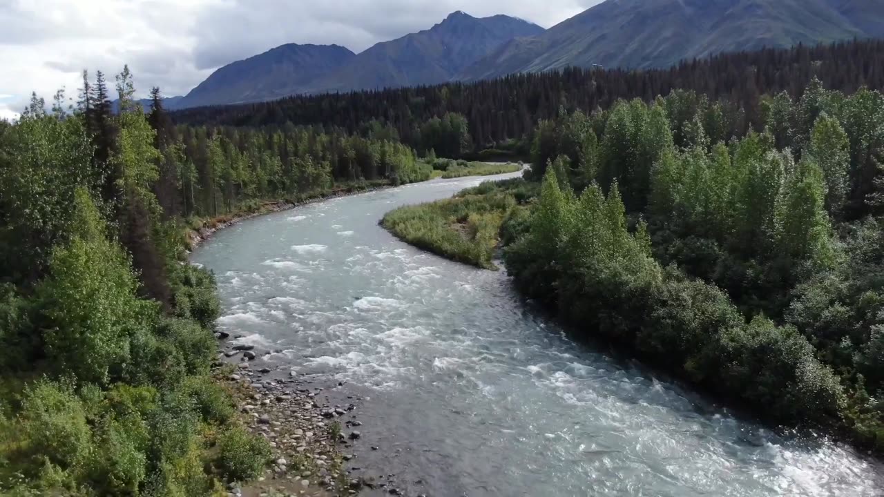
SWOT: Utilizing Earth Science Satellite to Enhance Community Future Planning.
Collaboratively spearheaded by NASA and the French space agency Centre National d’Études Spatiales (CNES), an innovative Earth science initiative is set to revolutionize future community planning. This visionary project aims to survey the globe's salt and freshwater bodies, offering insights crucial for addressing imminent challenges. The Surface Water and Ocean Topography (SWOT) mission stands at the forefront of this effort, utilizing advanced technology to gauge water heights in oceans, rivers, lakes, and reservoirs.
As the impact of climate change accelerates the planet's water cycle, a divide emerges: some regions grapple with excessive water, while others confront alarming droughts. In response, SWOT data emerges as a vital tool for enhancing flood prediction models and monitoring drought conditions. These invaluable insights will be pivotal for water management agencies, civil engineers, universities, disaster preparedness organizations, the U.S. Department of Defense, and other stakeholders invested in local water dynamics.
-
 LIVE
LIVE
MissesMaam
49 minutes ago*Spicy Sips* Friend Friday with Mally_Mouse and Friends!!! 💚✨
216 watching -
 LIVE
LIVE
ZWOGs
4 hours ago🔴LIVE IN 1440p! - Games w/ Maam, Kingdom Come Deliverance, & More - Come Hang Out!
23 watching -
 1:17:08
Kim Iversen
3 hours agoNetanyahu Declares WAR On Algorithms | Zionists Demand Megyn Kelly's Head
38.7K83 -
 LIVE
LIVE
Nerdrotic
4 hours ago $0.43 earnedDisney HATES YOU! But Needs You, James Gunn's Peacemaker, Alien: Earth | Friday Night Tights 368
1,662 watching -
 LIVE
LIVE
Quite Frankly
6 hours ago"Antichrist Summit, Cracker Barrel Syndrome, Friday Extras" ft Matt 8/22/25
512 watching -
 LIVE
LIVE
Wayne Allyn Root | WAR Zone
6 hours agoWAR Zone LIVE | 22 AUGUST 2025
140 watching -
 DVR
DVR
The Trish Regan Show
5 hours agoBREAKING: John Bolton Faces Up To 20 Years in Prison After FBI's Raid At Dawn - Kash Patel's Stunning Move
15.9K6 -
 1:36:29
Roseanne Barr
4 hours ago“MI6, Mossad & The Royals” W/ Bishop Larry Gaiters | The Roseanne Barr Podcast #112
141K53 -
 1:21:15
Sarah Westall
4 hours agoSocrates: 300 Year Cycle of Unprecedented Change after Worldwide War w/ Martin Armstrong
22.2K4 -
 1:57:27
xBuRnTx
2 hours agoLIVE - FORTNITE SOLOS - #AdRead
18.4K