USA Landsat Croplands Data Overview - NASA / ASTROSPECTRE
1 year ago
4
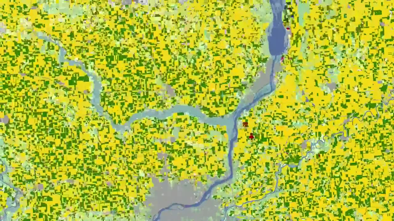
The U.S. Department of Agriculture tracks how many acres and the annual yield for every crop produced. One method used to estimate crop acreage and yield is remote-sensing data from the NASA-USGS Landsat satellite program. The program started in 1997,with North Dakota, and by 2008 covered the entire lower 48 states and the District of Columbia
#moon #orbit #space #earth #astro #astronomy #outerspace #nasa #cosmicdiscoveries #spacediscoveries #mercury
Loading comments...
-
 LIVE
LIVE
Donut Operator
23 minutes agoCRIME/ FLOODS: communityfoundation . net
160 watching -
 LIVE
LIVE
LFA TV
14 hours agoLFA TV ALL DAY STREAM - TUESDAY 7/8/25
5,247 watching -
 12:51
12:51
Dr. Nick Zyrowski
1 day agoThe INCREDIBLE Benefits of Red Light Therapy
5321 -
 2:20:07
Tucker Carlson
3 hours agoTucker and Saagar Enjeti on the Dangerous New Developments in Pam Bondi’s Epstein Cover-Up
54.1K39 -
 1:01:44
VINCE
2 hours agoICE Agents Aren't Safe | Episode 80 - 07/08/25
73.3K72 -
 LIVE
LIVE
Badlands Media
7 hours agoBadlands Daily - July 8, 2025
5,029 watching -
 1:09:55
Dear America
3 hours agoIT’S ALL A COVER-UP!! Don’t Be FOOLED!! + LA Mayor Tries To STOP ICE Raids!!
90.3K105 -
 LIVE
LIVE
The Big Mig™
2 hours agoIran Bounty On Trump Grows To $30 Million
5,253 watching -
 2:16:28
Matt Kohrs
11 hours agoTurnaround Tuesday 🚀🚀🚀 || Live Trading Options & Futures
20.7K1 -
 LIVE
LIVE
Wendy Bell Radio
6 hours agoNothing To See Here
9,114 watching