SWOt: Earth Science Satellite Will Help Communities Plan for a Better Future
SWOT: Earth Science Satellite Will Help Communities Plan for a Better Future
32K views · 9 months ago...more
NASA Jet Propulsion Laboratory
1.16M
Subscribe
423
Share
Save
Report
Comments32
God_Ozai
Flat earthers be like huh I didn’t see that it’s fake….
Up next
11:22
The Truth About NASA's New Space Station! (Axiom)
The Space Race•229K views
16:53
Friendly Guide to Climate Change - and what you can do to help #everytoncounts
Henrik Kniberg•341K views
9:04
The First and Only Photos From Venus - What Did We See? (4K)
V101 SPACE•2.9M views
53:32
Our Planet | Frozen Worlds | FULL EPISODE | Netflix
Netflix•29M views
6:53
The Final Launch of Discovery
Smithsonian National Air and Space Museum•1.9M views
13:21
Top 6 Inflammatory Foods to Avoid for ARTHRITIS: Reduce Joint Pain and Inflammation
Christiansen Felix•1.6M views
5:53
NASA | Earth's Water Cycle
NASA Goddard•687K views
6:31
NASA | Earth Science Week: Water, Water Everywhere!
NASA Goddard•190K views
3:07
Climate Change: How does it really work? | ClimateScience #1
ClimateScience - Solve Climate Change•61K views
5:40
Seasons: What causes summer and winter?
LiacosEM•79K views
9:01
Mars Exploration Rover 2003 (HD)
maasdigital•7.9M views
52:00
Unique Earth: The Essence of Water | Full Documentary
space and science•872K views
Description
SWOT: Earth Science Satellite Will Help Communities Plan for a Better Future
NASA Jet Propulsion Laboratory
423
Likes
32,707
Views
Oct 27
2022
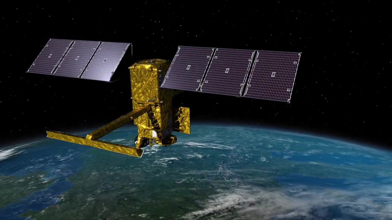
A new Earth science mission, led by NASA and the French space agency Centre National d’Études Spatiales (CNES), will help communities plan for a better future by surveying the planet’s salt and freshwater bodies. The Surface Water and Ocean Topography (SWOT) mission will measure the height of water in lakes, rivers, reservoirs, and the oceans.
As climate change accelerates the water cycle, more communities around the world will be inundated with water while others won’t have enough. SWOT data will be used to improve flood forecasts and monitor drought conditions, providing essential information to water management agencies, civil engineers, universities, the U.S. Department of Defense, disaster preparedness agencies, and others who need to track water in their local areas. In this video, examples of how SWOT data will be used in these communities are shared by a National Weather Service representative in Oregon, an Alaska Department of Transportation engineer, researchers from the University of Oregon and University of North Carolina, a NASA Jet Propulsion Laboratory scientist working with the Department of Defense, and a JPL scientist working with the Louisiana Coastal Protection and Restoration Agency.
:30 - Flood Watches & Warnings - Portland, Oregon
1:08 - Water Management - Fern Ridge Lake, Oregon
2:05 - Protecting Infrastructure - Alaska
2:54 - National Security - Department of Defense
3:24 - Coastal Protection - Mississippi River Delta
SWOT is expected to launch from Vandenberg Space Force Base in California in December 2022.
The mission is a collaboration between NASA and CNES, with contributions from the Canadian Space Agency and UK Space Agency. JPL, which is managed for NASA by Caltech in Pasadena, California, leads the U.S. component of the project.
To learn more about the mission, visit: https://swot.jpl.nasa.gov/
Credit: NASA/JPL-Caltech/CNES/Thales Alenia Space
-
 2:12:32
Badlands Media
1 day agoDevolution Power Hour Ep. 381: Live from GART – Clapper’s Leaks, DOJ Coverups & Trump’s Moves
77.2K29 -
 8:47:06
Rallied
12 hours ago $21.00 earnedWARZONE SOLO CHALLENGES ALL DAY
135K7 -
 5:05:38
StoneMountain64
8 hours agoBattlefield 6 Favorite Weapons, Vehicles, and Strategies
74.5K -
 1:10:03
Michael Franzese
18 hours agoWhy do we allow incompetent people in government decide our lives?
61.8K52 -
 1:33:49
MattMorseTV
11 hours ago $47.49 earned🔴Trump has a NEW DEAL.🔴
85.1K83 -
 2:55:27
Mally_Mouse
14 hours agoSpicy HYDRATE Saturday! -- Let's Play!
63K6 -
 1:38:06
GameWithV
8 hours ago $4.74 earnedSaturday Play
35.2K1 -
 5:32:09
Spartan
10 hours agoHalo for a bit, Octopath after maybe
42K -
 2:58:09
SavageJayGatsby
11 hours agoSpicy Saturday with Mally! - Wedding in 2 Months!
54.5K1 -
 1:47:14
VapinGamers
12 hours ago $6.74 earnedTools of the Trade - Does Production Matter? with Tim the Tool Man from Louder with Crowder
42.4K3