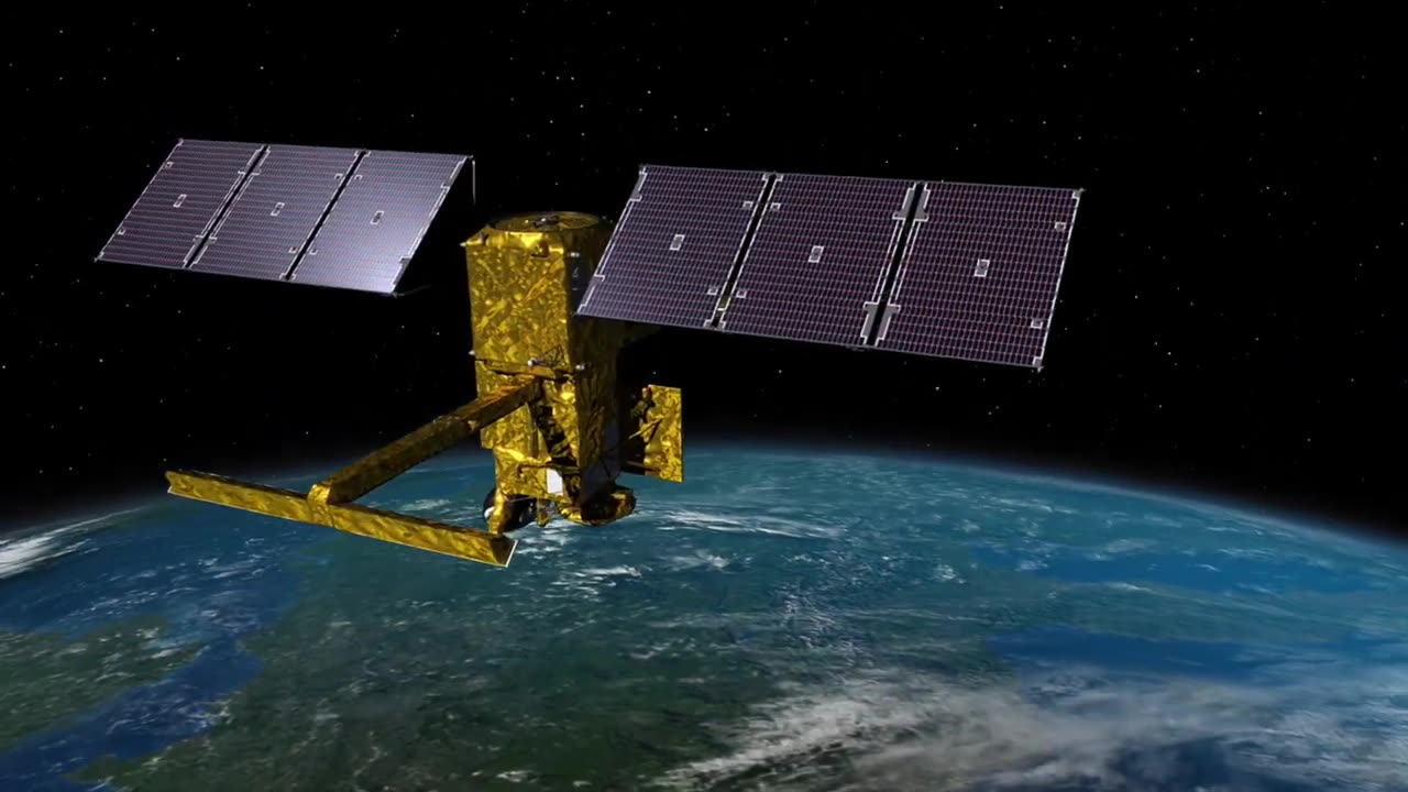
Exploring Earth's Oceans with NASA's SWOT Satellite
Dive into the fascinating world of Earth science with NASA's SWOT (Surface Water and Ocean Topography) satellite! 🌍🛰️ SWOT is a groundbreaking mission that takes us on a journey to unravel the mysteries of our planet's water bodies like never before.
SWOT's cutting-edge technology allows us to observe Earth's oceans, rivers, lakes, and reservoirs with unprecedented accuracy and detail. 🌊💧 By measuring the height of water surfaces from space, SWOT provides scientists, researchers, and policymakers with vital information about our planet's water cycle, sea-level rise, and much more.
In this video, you'll discover how SWOT's dual-frequency radar altimeter and wide-swath interferometer work in tandem to create high-resolution maps of water surfaces. 📡🗺️ These maps offer insights into ocean currents, eddies, and other dynamic features that play a crucial role in climate patterns and marine ecosystems.
Join us as we explore the significance of SWOT's data for understanding the impact of climate change on Earth's water resources. 💡🌡️ By tracking variations in ocean currents and sea level, SWOT contributes to early flood and drought prediction, enabling better disaster preparedness and response.
Learn how SWOT's data is being used to monitor coastal erosion, track the movement of pollutants, and study the intricate interactions between land and water. 🏖️🌊 The information gathered by SWOT is a game-changer in managing and conserving our planet's precious water resources.
Don't miss this chance to be part of the revolutionary journey with NASA's SWOT satellite as we work together to uncover the secrets of Earth's oceans and waterways. Hit the like button, subscribe, and turn on the notification bell to stay updated on the latest discoveries from space!
-
 2:07:34
FreshandFit
6 hours agoWhy You Are Unhappy Dating!
53K17 -
 1:21:38
Badlands Media
23 hours agoDevolution Power Hour Ep. 367
100K25 -
 2:28:09
Tundra Tactical
5 hours ago $7.36 earned🔥 NFA Hypocrisy EXPOSED: the Senate Just Screwed Gun Owners (Again) | Tundra Nation Live Roast 🔥
35.4K3 -
 3:44:43
DLDAfterDark
5 hours ago $3.97 earnedDLD Live! Red Dawn Readiness! HPA & Short Act Updates - T Rex Arms - Guns Gear & God
27K1 -
 LIVE
LIVE
GamersErr0r
5 hours ago $1.21 earnedMarvel Rivals Booty Bandit | Ft. SnoopLion
240 watching -
 56:47
56:47
Man in America
12 hours agoMEP Christine Anderson EXPOSES the SINISTER Plan for Global Slavery—and How We FIGHT BACK
73.4K22 -
 3:44:43
BlackDiamondGunsandGear
4 days ago🔴 DLD After Dark w/ Redawn Readiness / They don’t care. They not gonna start now…
23.1K3 -
 46:55
46:55
The Connect: With Johnny Mitchell
16 hours ago $2.54 earnedInside A Mexican Sicario Training Camp: How The Jalisco New Generation Cartel Trains It's KILLERS
25K4 -
 9:03
9:03
MattMorseTV
13 hours ago $3.69 earnedTrump just SHATTERED the RECORD.
32.4K22 -
 4:23:21
BubbaSZN
6 hours ago🔴 LIVE - DAY 5 OF THE FORTNITE SUMMER EVENT W/ CATDOG
17.4K