3D map of Antarctic sea ice to shed light on climate change
10 years ago
38
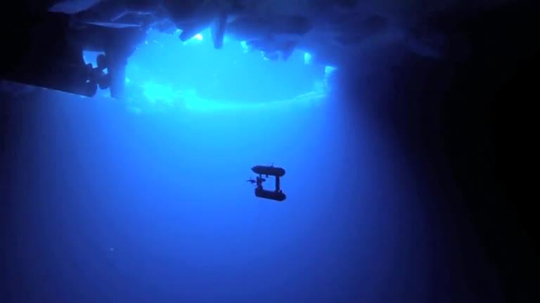
A multinational group of scientists have released the first ever detailed, high-resolution 3-D maps of Antarctic sea ice. Using an underwater robot equipped with sonar, the researchers mapped the underside of a massive area of sea ice to gauge the impact of climate change. Ben Gruber reports. Credit to Reuters.
Loading comments...
-
 0:14
0:14
rumblestaff
4 years agoDeaths due to climate change. A powerful reminder to all
2943 -
 4:43
4:43
LifezetteMedia
5 years agoWhy should I believe in Climate Change?
4.21M51 -
 3:43
3:43
KGTV
5 years agoCoronavirus Isolation may help reverse climate change
56 -
 1:11
1:11
Newsy
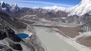
4 years agoStudy Says Glacial Lakes Grew 50% As Climate Change Shrinks Glaciers
667 -
 1:29:07
Rebel News
2 hours agoRon betrays Don again, Carney's conflicts of interest, Will owners respect gun grab | Rebel Roundup
21.6K10 -
 1:00:02
The Tom Renz Show
2 hours agoEpstein, the Autopen, & the "Major Investigation"
16.3K8 -
 1:25:11
Nikko Ortiz
3 hours agoBody Armor Review And Giveaway!!
37.9K1 -
 1:41:44
The Mel K Show
3 hours agoMORNINGS WITH MEL K - Destructions, Devision & Denial: Staying Focused on What Matters Now 7-14-25
26K8 -
 1:27:46
Flyover Conservatives
14 hours agoFlyover’s Take: The Epstein List, Trump, Bongino & Bondi Drama; Warning or Opportunity? Massive Moves in Gold & Silver - Dr. Kirk Elliott | FOC Show
26.6K3 -
 1:08:03
The Rubin Report
4 hours agoMegyn Kelly Destroy Pam Bondi’s Epstein Narrative w/ Facts in Under 5 Minutes
124K86